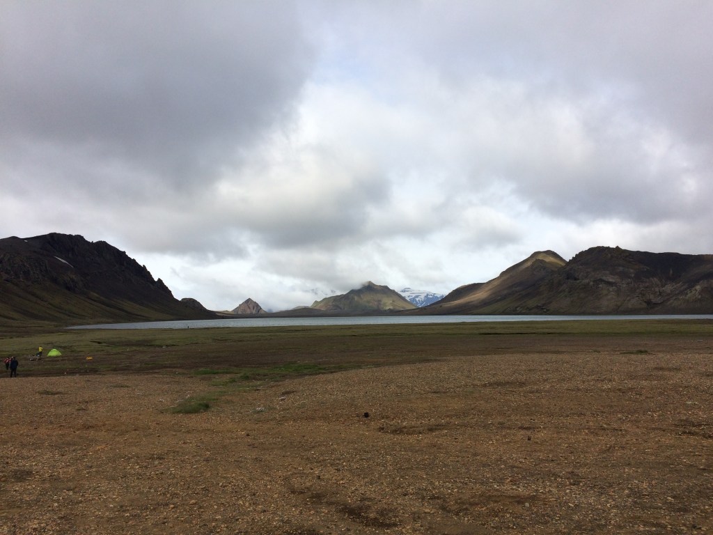
I am up early because basically it is daylight, and there are the dulcet tones of snoring reverberating around the hut. So I head out to the shower block and find that I am not alone in having a quick face wash etc at the sink. It is cloudy and the wind is blowing but it is possible to glimpse mountains in the distance. More importantly, it is not raining! I also realise that I have a mildly corked right thigh (from the descent off the Caldera in harsh conditions the previous day). How I will get on during todays trek now remains to be seen!
The morning routine from the previous day is repeated once it is 6 am, which includes packing unwanted items and sleeping gear into the duffle bag which will be transported. Outer gear snacks and the all important plastic cup are placed into the back pack. As soon as it is 7 am there is activity in the kitchen where Solvi (our guide) and his helpers fire up the gas burners for porridge along with hot water for the coffee. Meanwhile I stretch my legs and loosen up as much as possible despite the pulling in my corked thigh!
We all sit down for breakfast and then it is sandwich making time (I focus on cheese, tomato and cucumber). Once everything is tidied up there is a final briefing about what we can expect (today there are a number of water crossings) and then off we set.
Up over the Bratthals ridge we head and then follow an F road for a short distance. At this stage there is a glimpse of blue sky and there is the first sighting of the Myrdalsjokull glacier. I am hoping that today will be the day that the cloud rolls back so that we can see even more of the spectacular scenery. At this stage it looks promising.
Down the side of the ridge we head towards the Bratthalskvisl River which now has to be crossed. My right thigh twinges at times so it is short strides, combined with optimising the use of my trekking poles. This is where ones river crossing skills are put to the test (after the most appropriate location has been selected). So it is off boots, roll up trousers and on sandals. The back pack harness straps are left unclipped (so that it can be ditched in the event of a fall into the river to avoid being dragged under by the weight).
It only takes a couple of steps to appreciate how cold the water is (foot numbing), so this is a major incentive to get across as quickly as possible! However, foot placement is critical on the river bed to prevent slipping. Once on the opposite bank it is off sandals, dry the feet and legs and on boots (this is to be repeated later in the day).
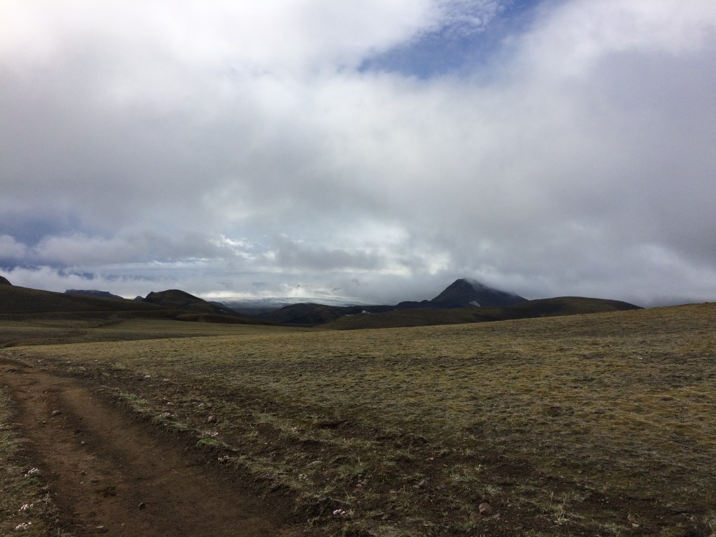
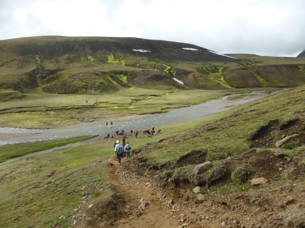
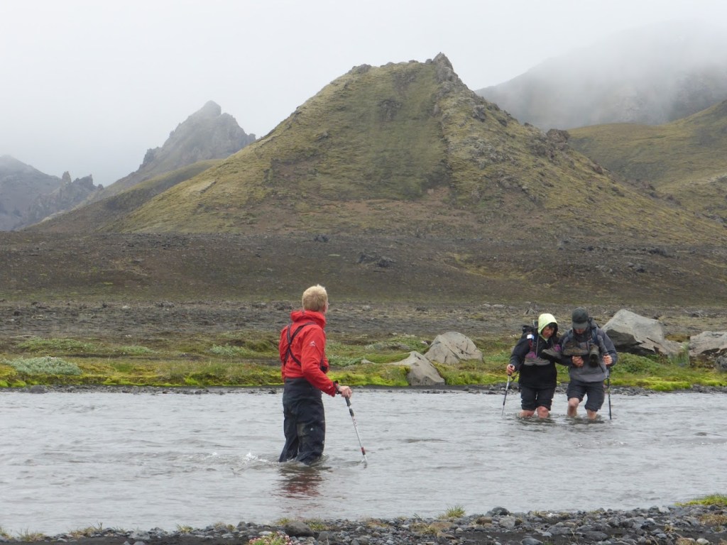
We set off over another ridge with more in the way of greenery from both the lichens and moss being visible, followed by another descent. I am a bit slower on the downhill sections but this cannot be helped (if I want to complete this trek I have to nurse my right thigh)! Eventually we rest for a short while at the Hvanngil huts before pushing on across a barren region, littered with rocks. Solvi tells us yet another story of people who have lost their lives in this region whilst travelling along this way. Then there is another river which is deeper!! So the additional precaution of crossing it in pairs is required (for stability against the current). By this stage the damp mist has descended again and the wind is blowing!!! I cross with one arm locked with that of one of my fellow trekkers whilst Solvi watches vigilantly over every pair crossing from the group (as in the below photo). Rapid action would have been required if anyone had tumbled into the water, because hypothermia is a significant risk in these conditions.
I sit down to take my sandals off, dry my legs and get my boots back on. My feet are white from the cold (& numb!!!). This fortunately only lasts several minutes as the circulation returns (and my toes mercifully pink up again). Solvi breaks out the coffee and chocolate and we then have a short break to ensure that everyone has recovered from the crossing and feels able to continue.
Onwards we head, by which stage there is now misty rain. Lunch is to be near the fast flowing Kaldaklofskvisl River, which we mercifully cross first via a bridge, as it would be far too dangerous to cross any other way! This bridge was a significant enabling factor in the Laugavegur trail becoming established as a trekking route. Nearby there is also a large rock which we can use to shelter from the wind. At this stage we are surrounded by rocks (again). The mountains are mainly obscured by cloud (sigh)!
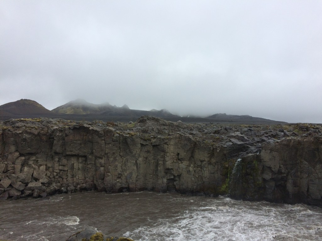
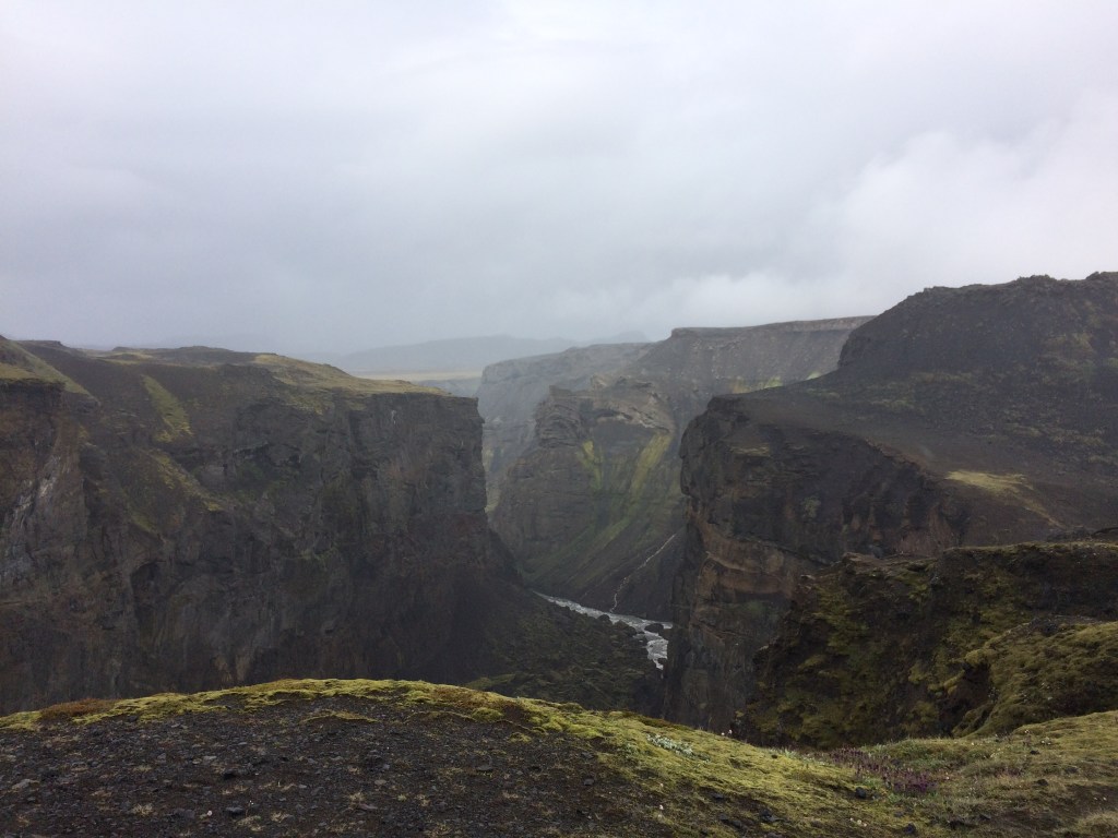
Following lunch we trek across the region known as the Maelifellsandur black sands. This is when sand seems to start getting on everything (something to remember if you want to trek this trail in fine weather-you may need gaiters). The low cloud ceiling obscures the higher mountain tops including the peak of the nearby Hatfell volcano. Mid afternoon we stop for the obligatory break in a gulley out of the wind. Solvi promises us that he has something special to show us (so we all keep our hopes up despite the low cloud!). Onwards we trek over more sand and then rocks of varying sizes. We are now up on a ridge and Solvi is saying, not long now. All of a sudden we head down around a corner and up a small rise and there is the magnificent Markafljotsgljufur gorge with the Markarfljot river at the base. The cloud lifts a little although there are still patches of misty rain. Out come the cameras!
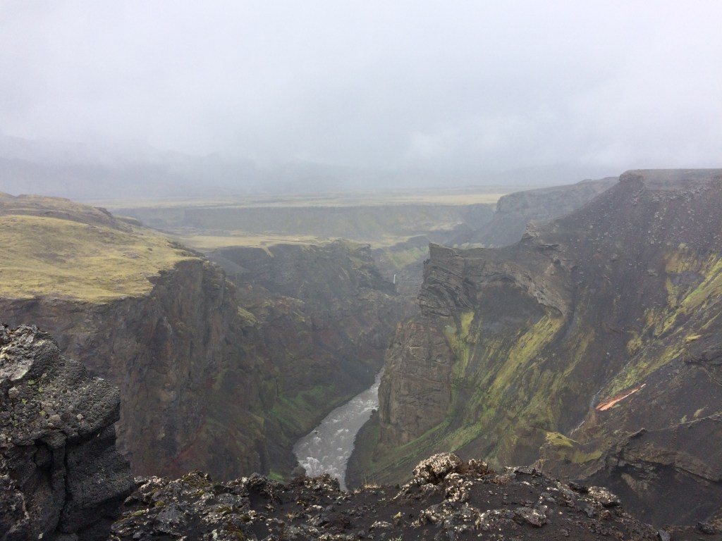
We trek alongside this gorge until we reach another viewing point. There are some birds flying around (Arctic fulmars, which are nesting on the walls of the gorge), and with there also being a hint of sunlight it is simply a magnificent view.
After multiple photo opportunities and marvelling at the gorge we then head up over our last ridge for the day and are greeted by the sight of the Emstrur huts the other side. Our group is to be accommodated in one of the huts but it will be a tight squeeze (two to a mattress again)! Following the usual discarding of wet gear, sorting out of bedding and a warm drink, most of us opt for the 5 minute hot shower in the nearby amenities hut. This is a test of ones organisation skills! As the Emstrur huts are out of the wind (as they are located down the side of a ridge), the conditions outside are far better than the previous 2 nights. However the low cloud ceiling limits photo opportunities.
The kitchen crew sets about cooking dinner in a very small space, and the main course (which is salmon), is cooked outside on a barbecue. Following dinner Solvi gets his maps out and show us where we have been and where we are heading the next day. We also receive some additional information about the local volcanic geology as well as the nearby glaciers. Not long after this we all turn in. Of course there is no darkness!
To be continued : Trekking the Laugavegur Trail in Iceland – Day 4: Emstrur to Langidalur
