After a solid 8 hours sleep I slip out into the brilliant morning sun and gaze at the nearby scenery including the magnificent Eyjafjallajökull glacier. The local bird life are already frenetically busy for the day (there is a lot of chirping going on nearby). My legs have recovered from the rigors of the Laugavegur trail and I am optimistic that the 1000 metre climb later today will not be an issue. As others stir, I start packing the gear that I don’t need for the next 2 days into a duffle bag which I will not see until Skogar. Everything else for the next 2 days then goes into the backpack.
We all assemble in the downstairs dining room for breakfast. In view of the climb I have porridge with Granola mixed into it for the extra energy. Then we each make our sandwiches for the next two days (which also go into our backpacks). We then help Solvi (our guide), carry items down to the pick up area for the bus service as all extra food and gear are to be transported out of the area. The sun is out and I am hoping that it will stay this way.
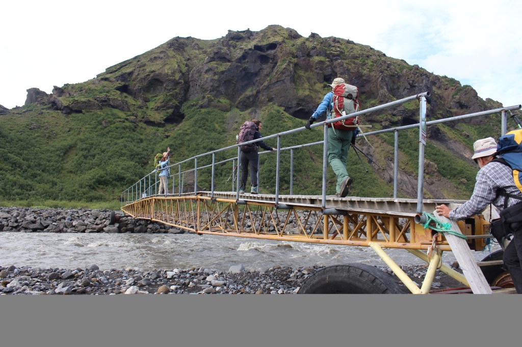
Of we set, walking along the Krossa valley, where we initially cross a river tributary via a small wooden bridge. Mercifully there is a larger metal bridge that has been swung into place across the main river channel which we can then all cross. This takes us to the path leading to the Fimmvorouhals trailhead.
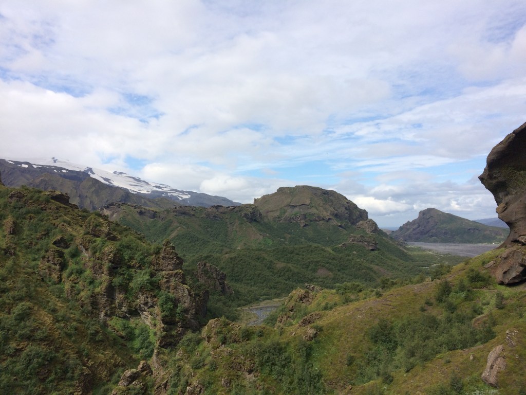
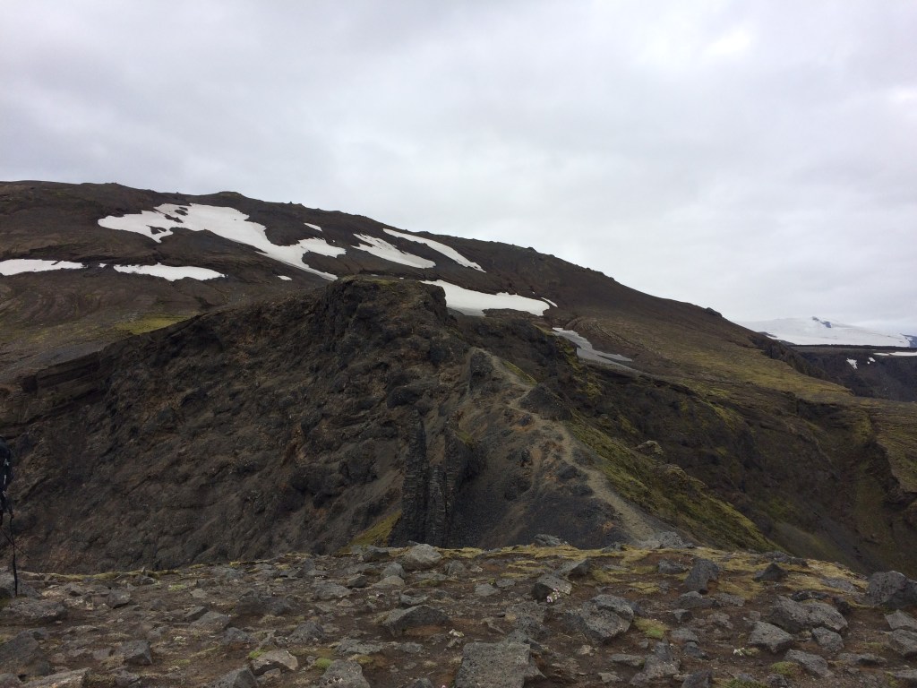
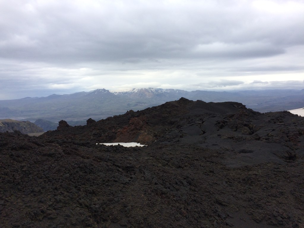
The climb commences initially through patchy birch forest and then up across the first couple of ridges. I am able to look back at times along the Strakagil canyon towards Langidalur (see below), with the Eyjafjallajökull glacier to the left and Valahnuker in the distance across the river valley.
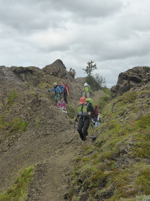
Once we are predominantly above the tree line the climb becomes a bit more technical with the requirement to hold onto either fixed ropes or chains at times. I do not even try and take a photo of the narrow Kattarhyggir ridge (with the sheer drop on either side) as we cross. Safety comes ahead of photos!
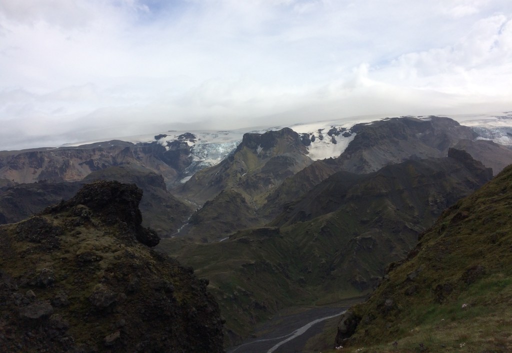
There have also been some great views of the Myrdalsjokull glacier as we ascend, but the cloud is steadily increasing!
Finally we reach a small plateau known as the Morinsheidi flats, from which there is another great view of the Myrdalsjokull glacier. However the sun is beginning to vanish behind the clouds and the wind is now really blowing! There have been lives lost on this trail (mainly due to people being ill equipped for the weather and pushing on in poor conditions). At one stage we pass a poignant memorial.
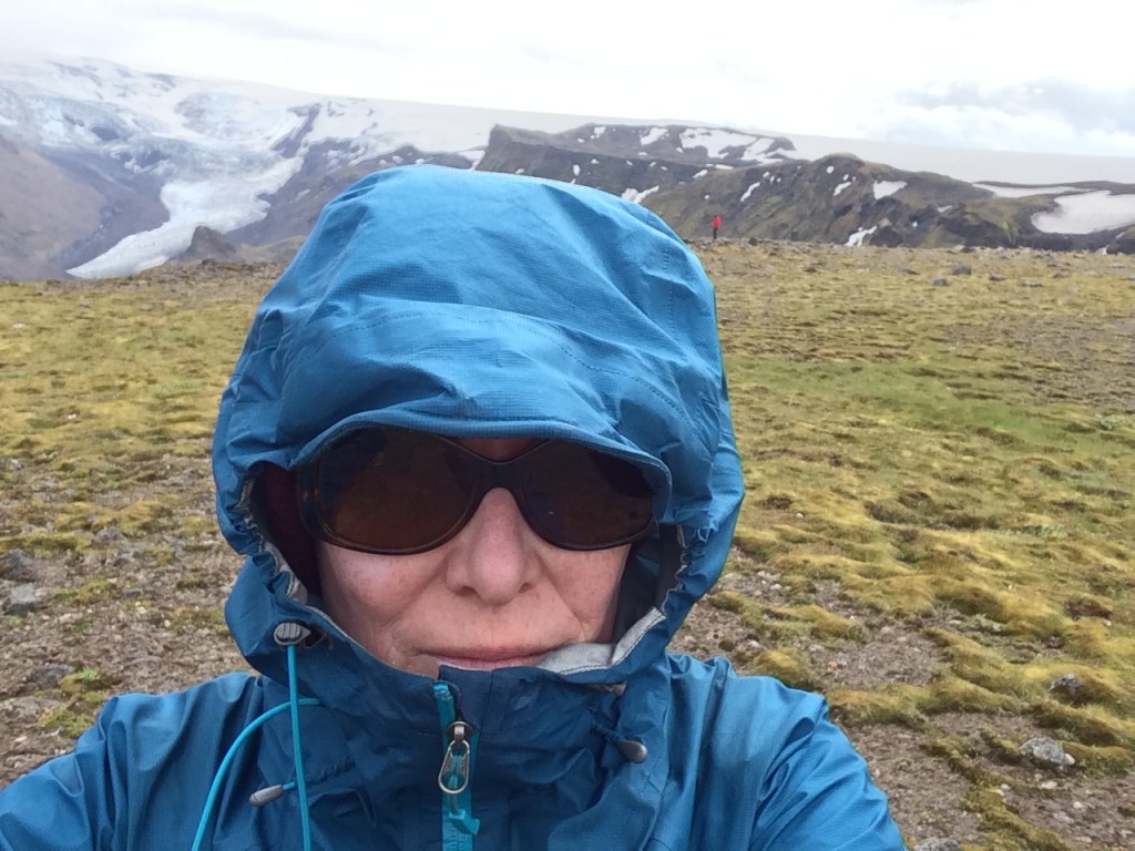
In fact by this stage the wind is blowing so much that I have had to put on all of my outer wind shell gear and a woollen beanie! You can see the mossy lichen behind me on the ground (it is like sponge), which you have to avoid treading on!
We head on a little further until we stop for lunch on what would normally be a great spot with a spectacular view. However the wind chill is so bad that most of us spend our time either crouching/sheltering behind the larger rocks! So lunch is a very brief affair, with sandwiches and coffee being consumed rapidly.
Not long after leaving our lunch spot we are at the base of the Godahraun lava field (from the first eruption of Eyjafjallajökull in 2010). I look up, and yes this is what we are about to climb (see below)!!! Somehow this picture does not quite do justice to the height of the lava bed. Solvi spends some time explaining about this particular eruption before briefing us about the climb. The first ridge is known as Heljarkambur where there are some tricky narrow sections to the trail (with chains to hold onto!).
The cloud has rolled in and the wind is blowing off the nearby glaciers so in preparation for the next climb, on goes the neck gaiter. If it gets any worse the sun glasses will have to be replaced by the snow goggles!
Following a slow technical climb up the face of the lava bed punctuated only by the odd trekker descending in the opposite direction, we reach the top. The glaciers on each side are now obscured by the low cloud ceiling but once over the ridge top there are the two volcanic cones from the first 2010 eruptiom of Eyjafjallajokull to explore. These are Magni (on the left) and Modi (on the right), named after the sons of Thor.
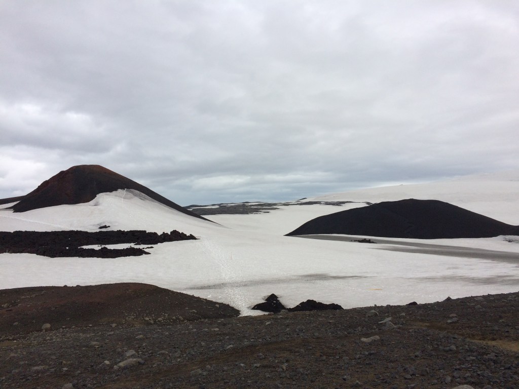
We head off and climb up the smaller Modi which is composed of loose coarse volcanic rock, followed by trekking nearby to look at some of the nearby exposed lava. In the distance looking back across the rugged lava field the Tindfjallajokull glacier and nearby mountain peaks can just be seen. This is the only glacier not obscured by cloud by this stage!
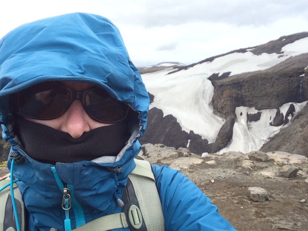
Then we head across to the second volcanic cone (Magni) and climb to the top where the views are now extremely limited by the misty cloud. So down the other side we go (being careful not to slip on the loose gravelly sharp volcanic rock). My digital phone battery supply is rapidly dwindling (largely due to the wind chill), so that is it for photos at this stage.
We trek on and then have to veer off the Fimmvorouhals route in order to reach the Fimmvorduskali hut. Most of this part of the journey involves trekking across snow, after 1000 metres of climbing! We have split mainly into two groups by this stage, the faster walkers at the front and the slower ones bringing up the rear. I stick with the rear group as it is important for both visibility and safety to stay together! There are other people on the trail even at this stage and you hope that they can either find shelter for the night or are able to trek on to a trailhead.
We finally reach the hut and are warmly greeted by Bjork the hut warden for the week, who has made sure that it is nice and warm inside. So it is off with the damp gear and boots in the vestibule and then we arrange ourselves inside the compact main room of the hut around the table. Water has been on the boil for a hot drink and we can have a welcome snack. Solvi sets about organising what is for dinner (it will be rehydrates dried camping food along with tinned ham). This hut is resupplied at the beginning of the season and involves specially equipped alpine terrain vehicles being brought up the mountain!!!
After dinner we hear about what it is like to be a hut warden and how the emergency services would respond if someone broke a leg (which is good to know!). There are no views to be had because outside it continues to be heavy white mist and this has been like this since we arrived. I pull out my sleeping bag liner and pillow out of my back pack, rearrange some gear an turn in for the night (not that there will be any darkness)!
Not long after this we all turn in, it is fair to say that 1000 metres of climbing has led to some tiredness!
To be continued: The Fimmvorouhals Route Iceland – Fimmvorduskali Hut to Skogar
