Tales from the Via Podiensis- b) Traversing the Aubrac plateau

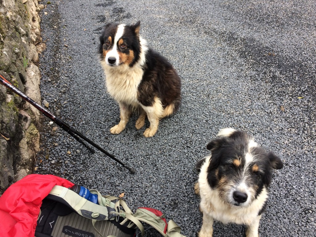
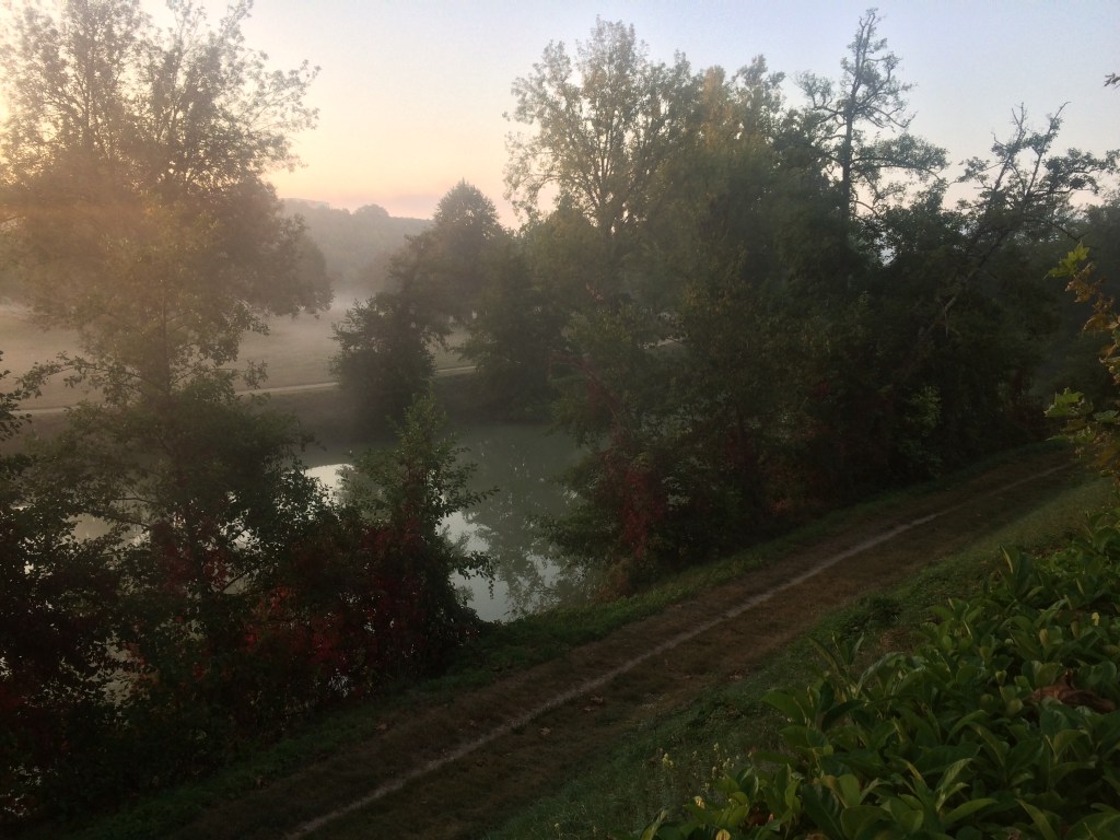
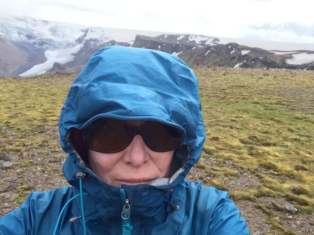
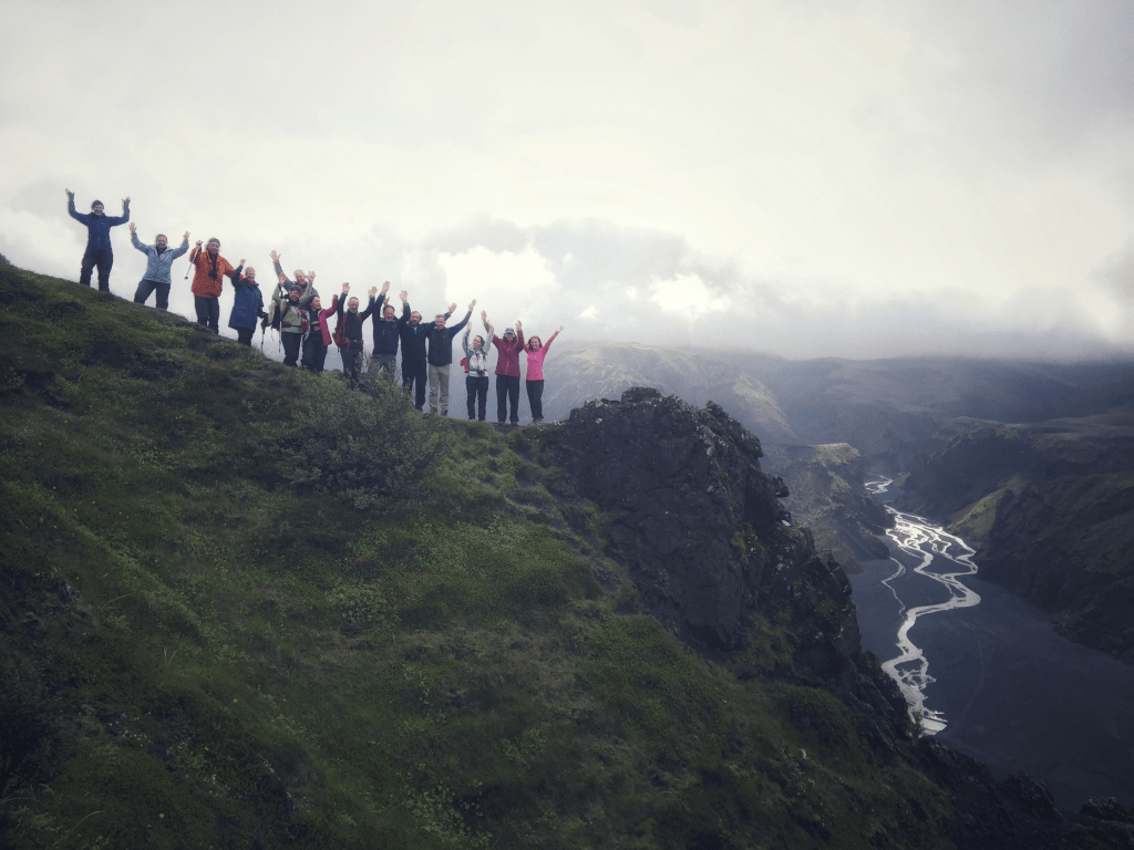
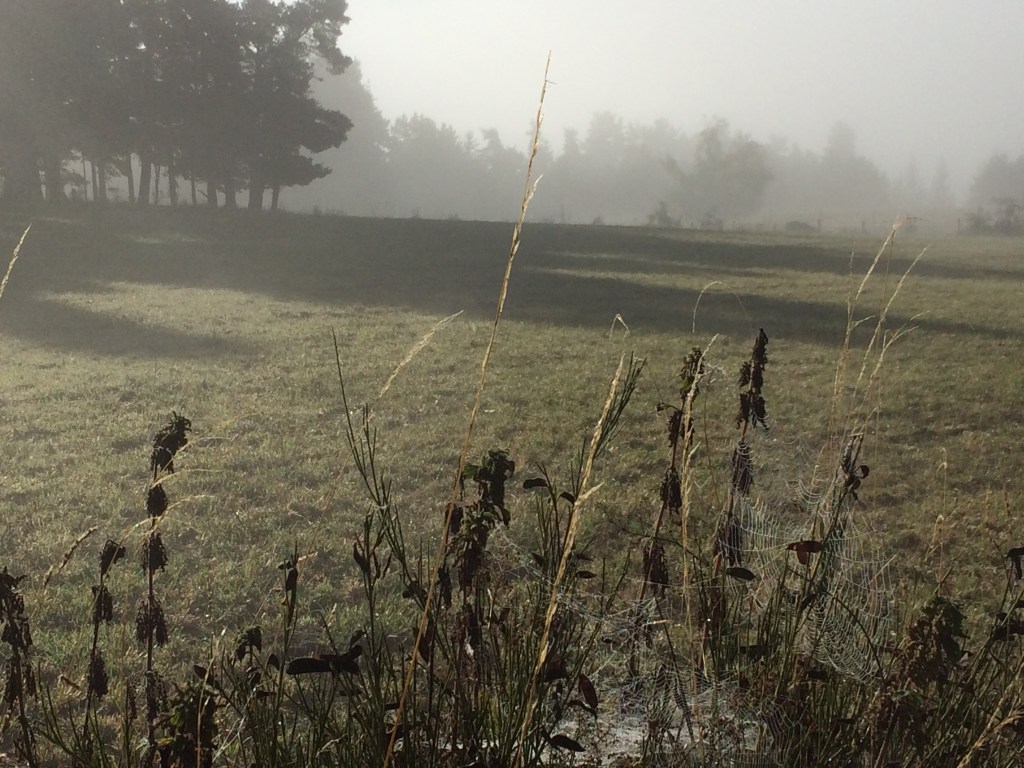
Breakfast has already become an exercise in fuelling up for what turns out to be half a morning (depending on how many hills there are). This includes downing two large cups of coffee, except more often than not the coffee is served in bowls and if you want milk (lait), then this has to be added. Then I head out into the mist! The camaraderie amongst the hikers on the trail is excellent. I assist one woman hiker with directions on one occasion and am impressed with the offers of food from other hikers along the trail. In addition there is advice as to how to obtain fruit from some of the trees by the trail. Some of the French hikers are expert at scavenging fruit!

Morning mist

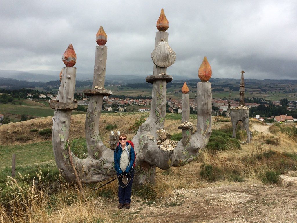
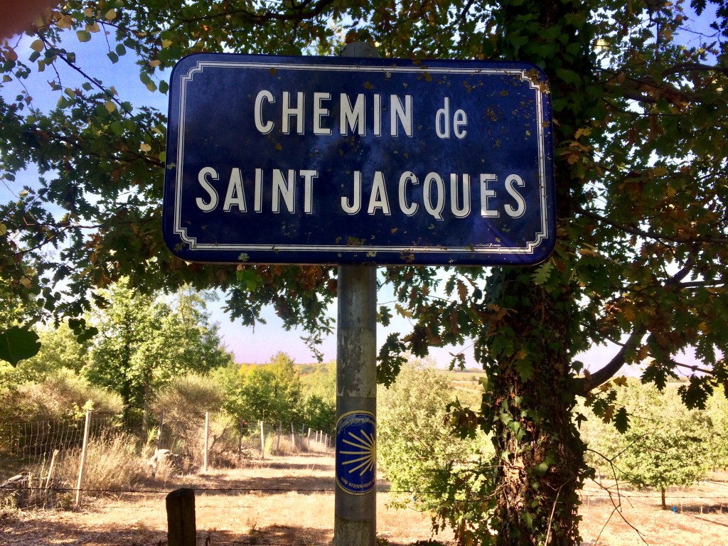
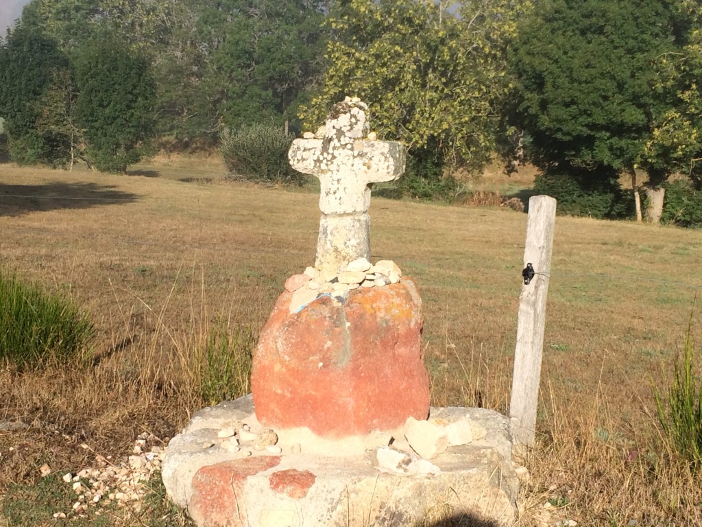
There continues to be an assortment of wayside crosses along the GR 65 (Grand Randonnee), some made of stone and some made of iron residing on plinths. If you see one of these you know for sure that you are on the GR 65, as crosses were used historically as wayside markers, before the system of modern markers and signs were introduced.

Stone cross near Le Rouget

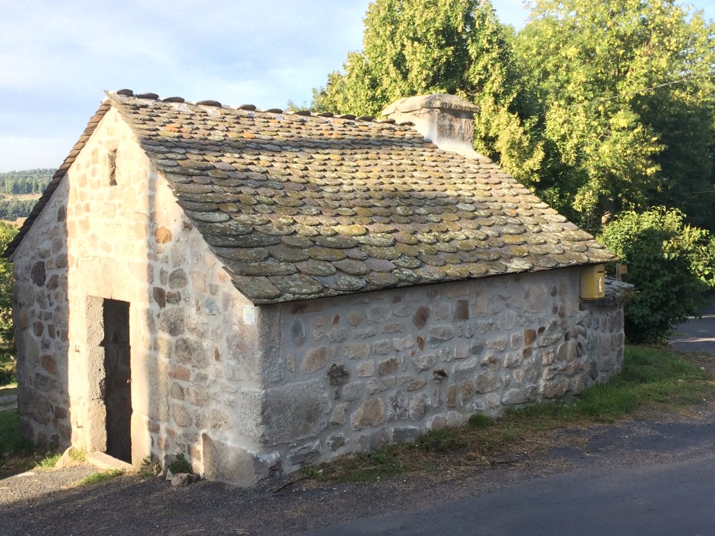
At the weekends the hunters are out in the forests, and often you could hear them (the sound of the horn, the barking of the dogs and the odd gun shot). Hence it was best not to deviate from the GR 65! There are new sights to see including several old communal ovens built in the style of the older rural buildings in this region.

Communal oven Lasbros

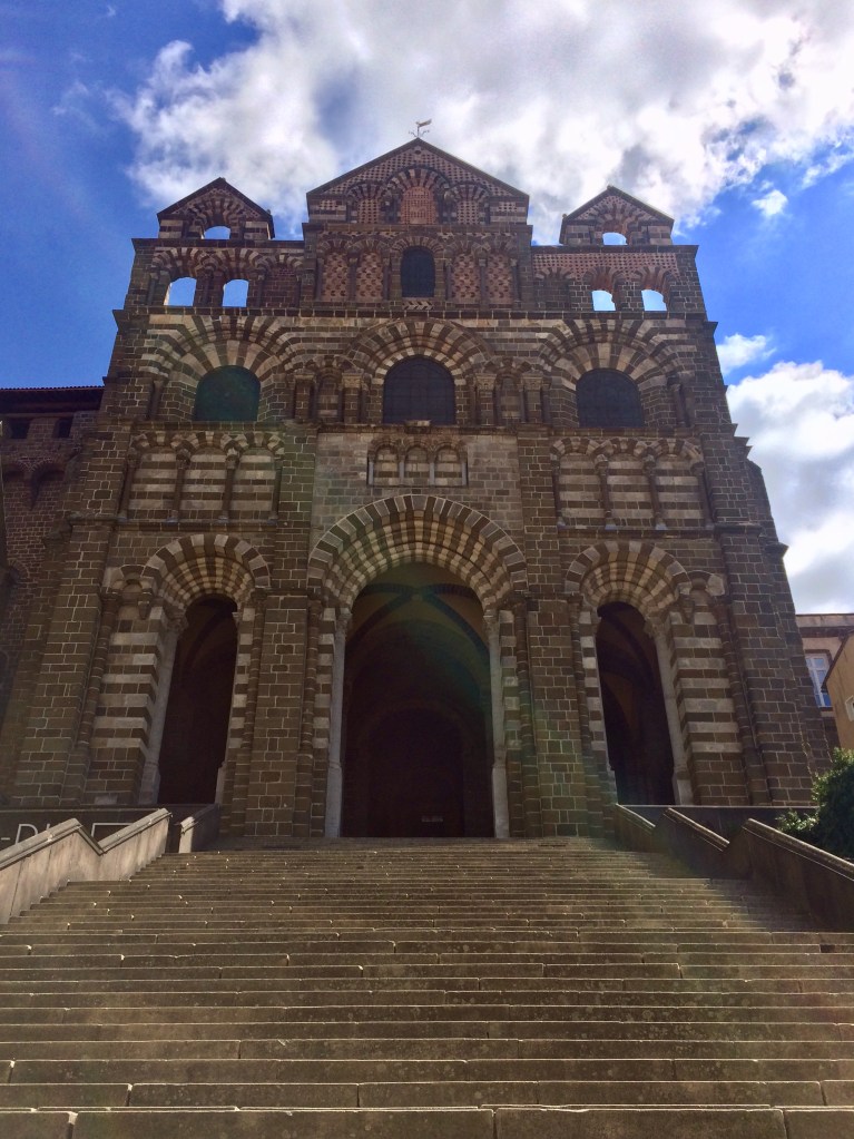
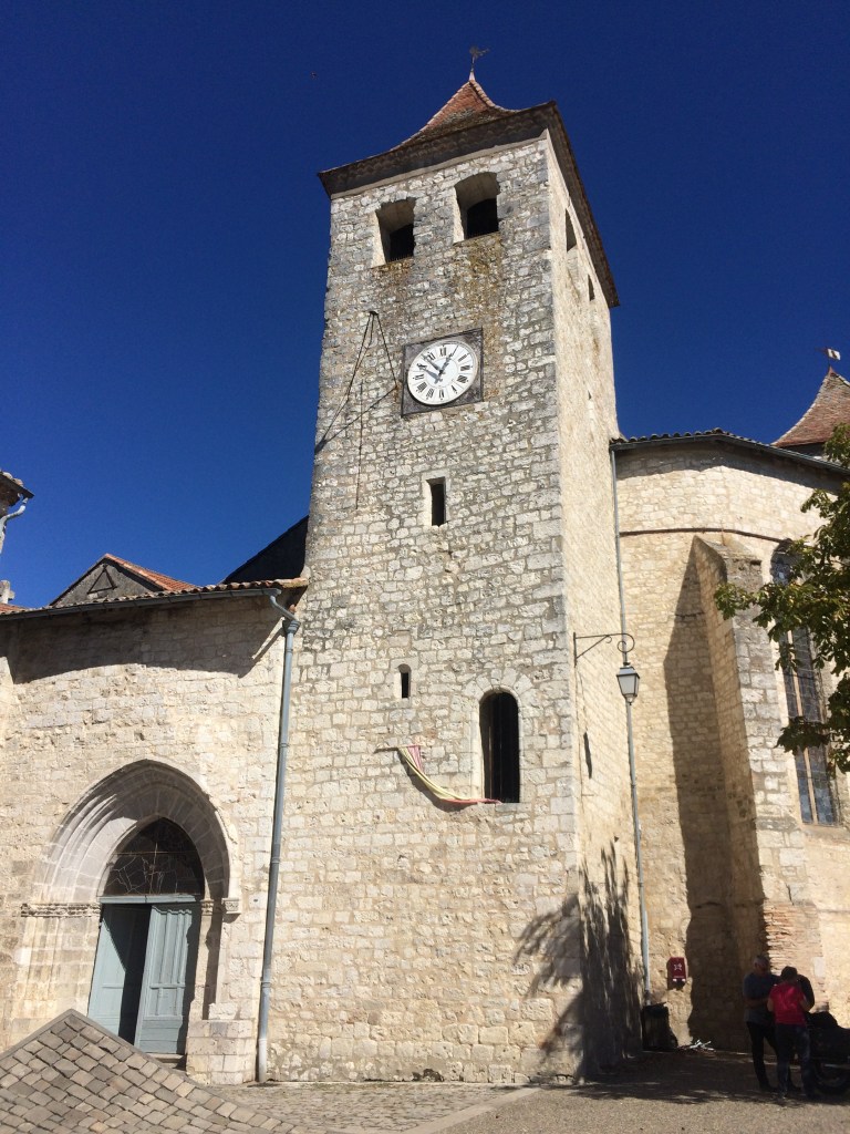
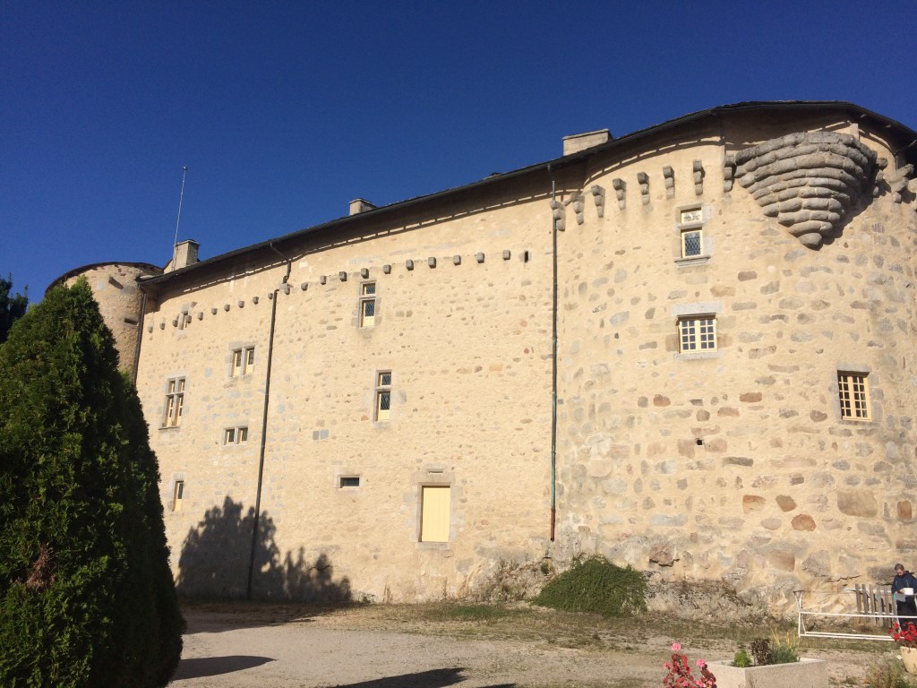
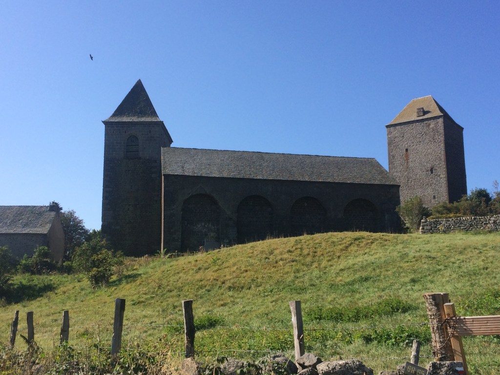
Every now and then you come across a larger village with even more magnificent old buildings as well as an old church but depending on the time of day these may not be open. Villages are also a good place to find a WC, although at times the facility can be quite basic (think hole in the ground arrangement) !

Chateau St Alban sur Limagnole

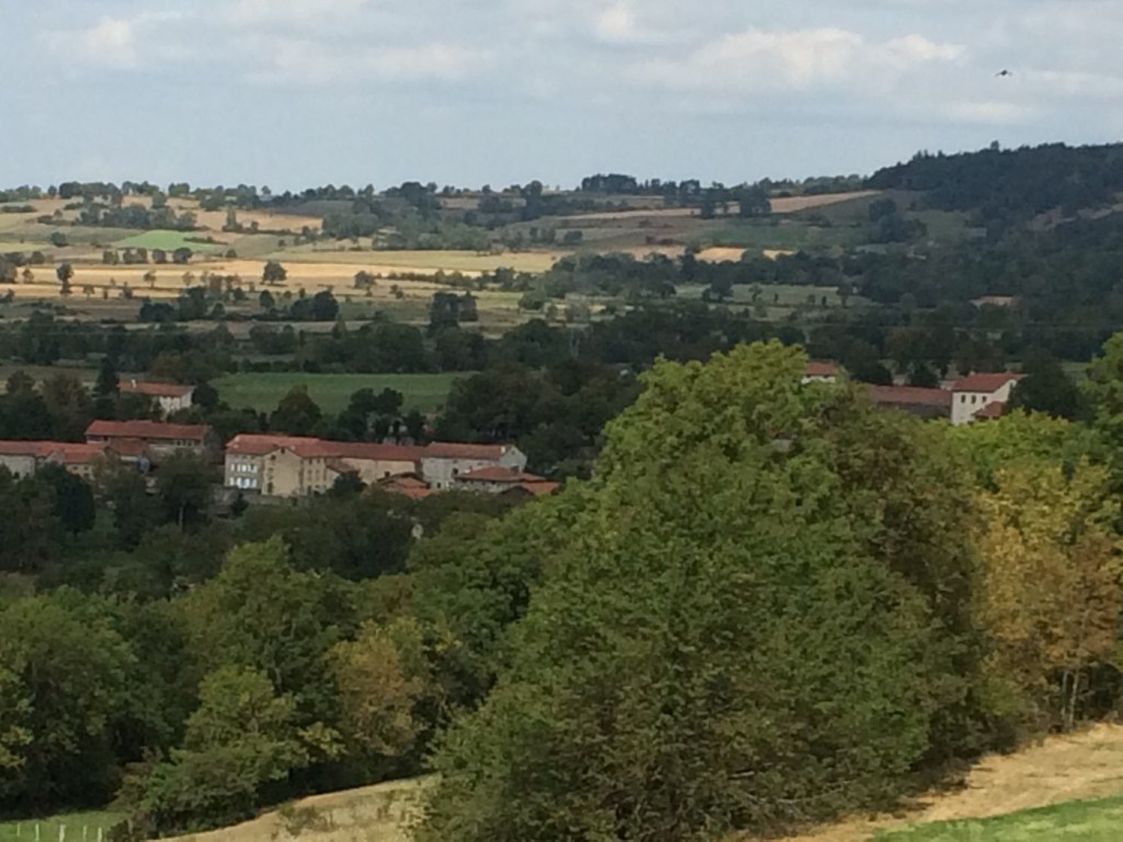
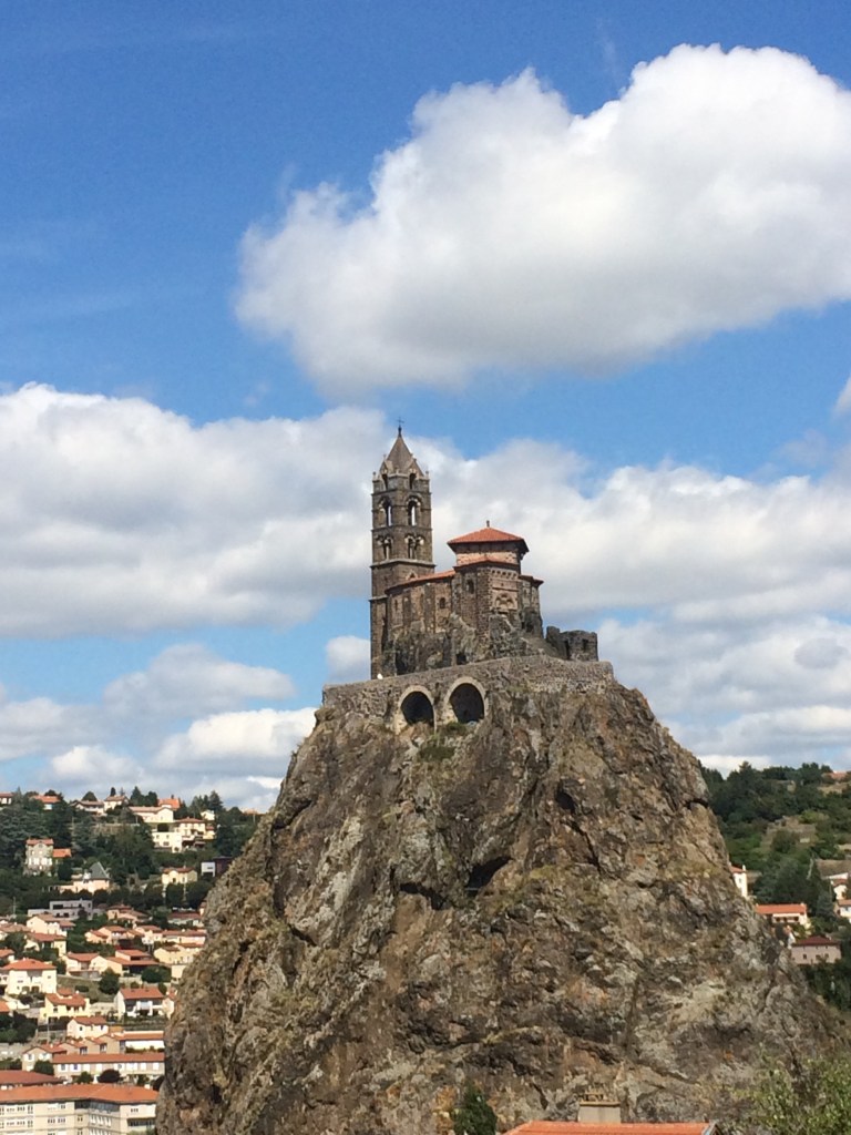
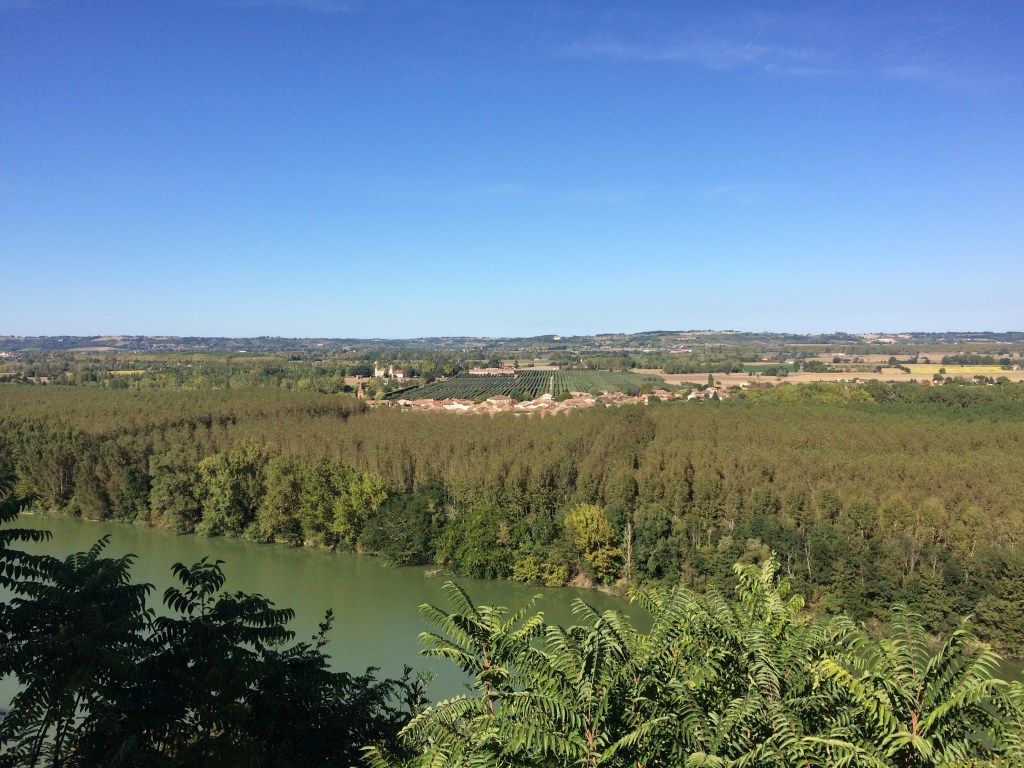
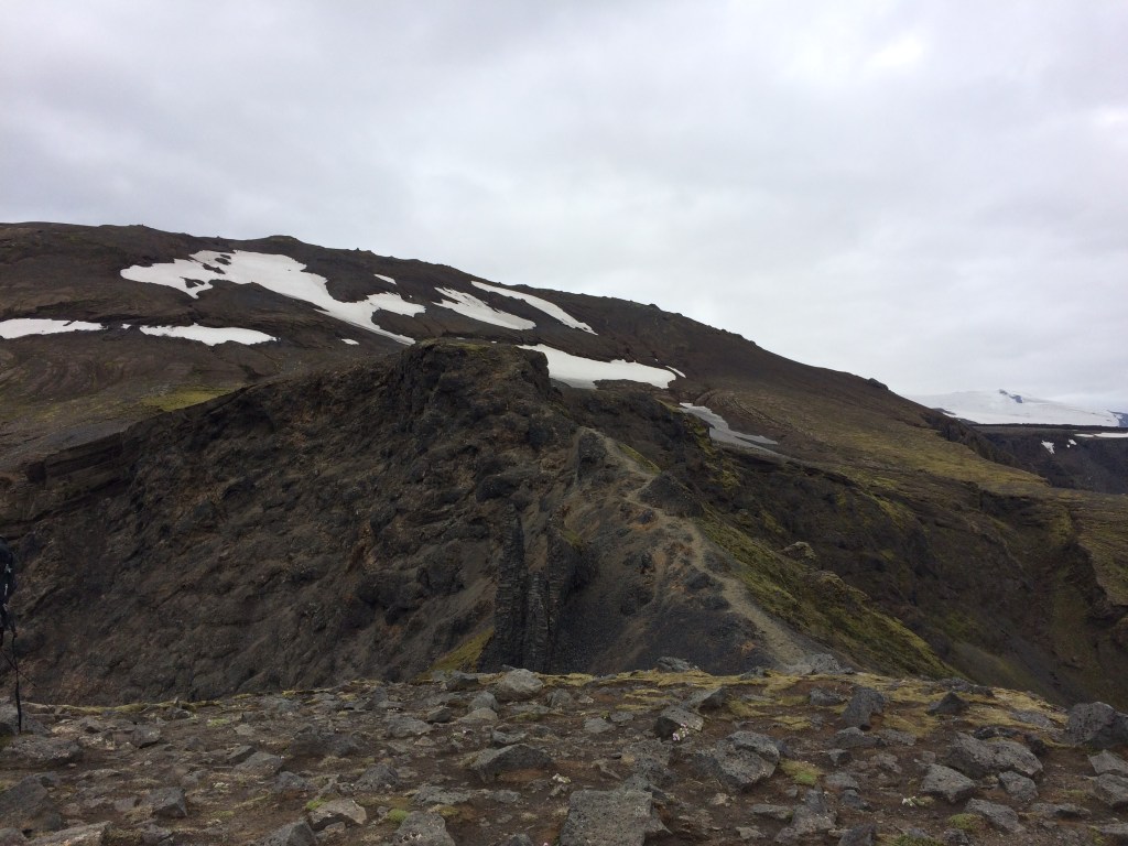
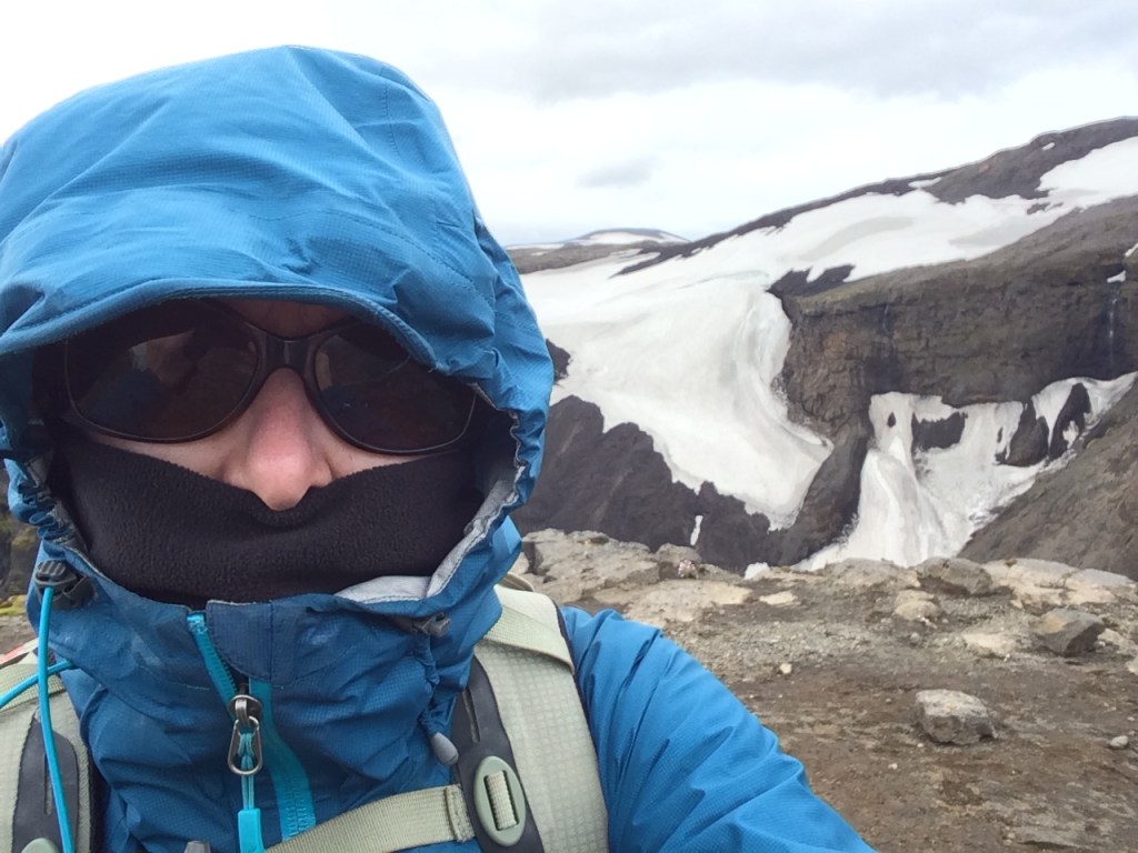
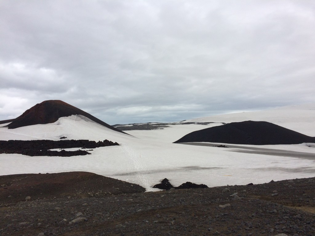
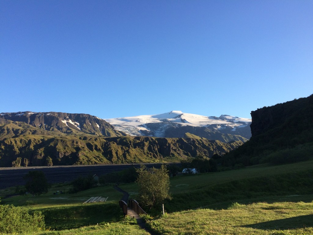
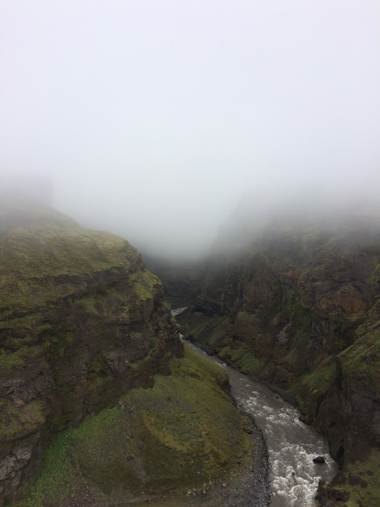
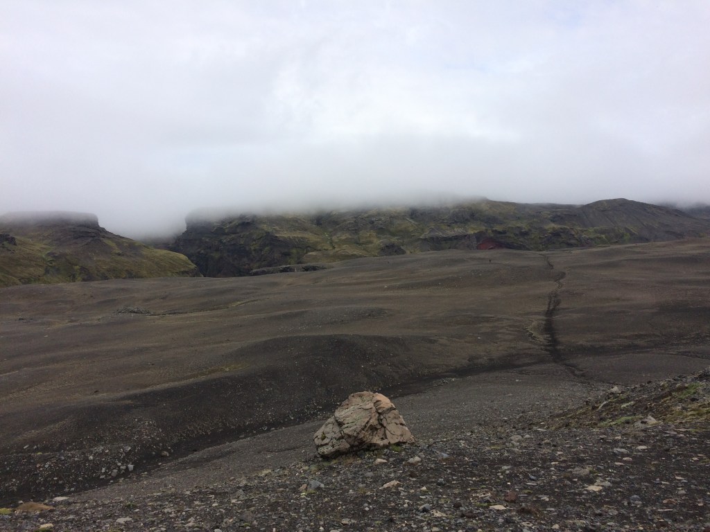
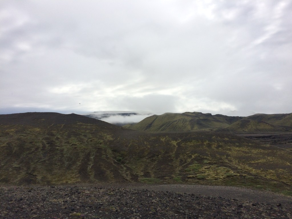
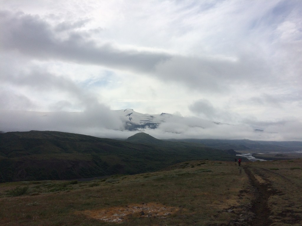
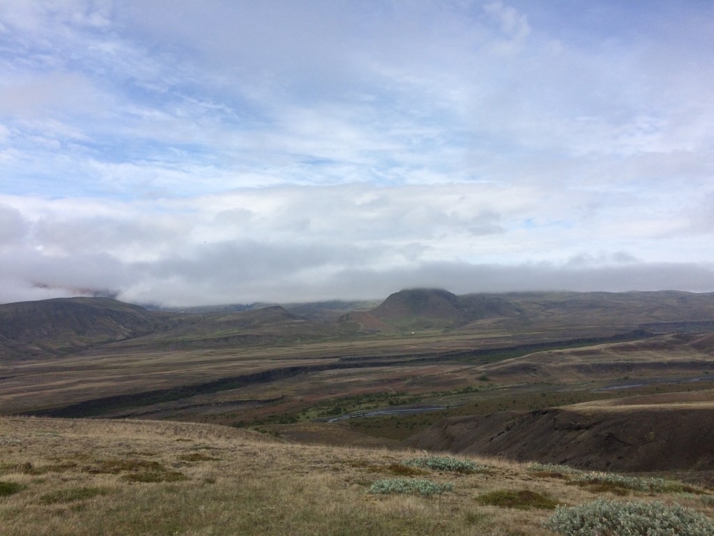
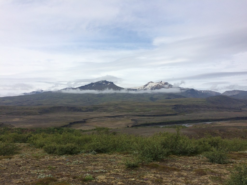
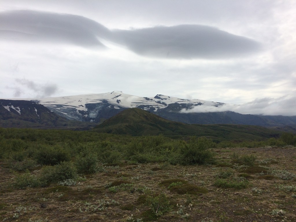
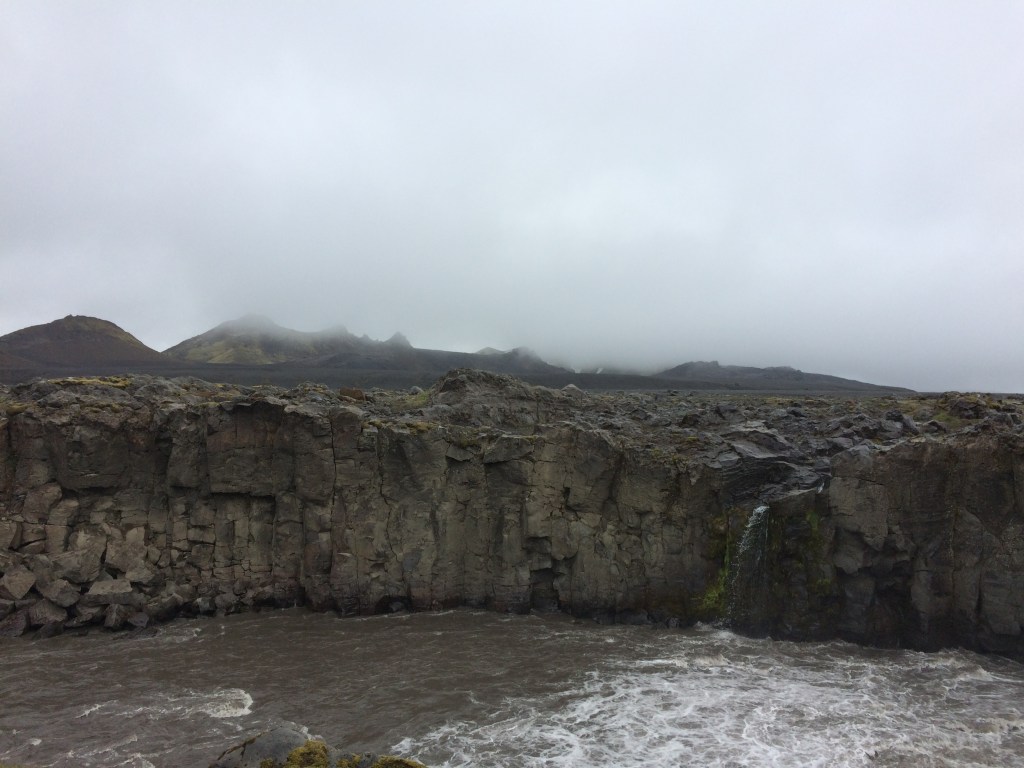
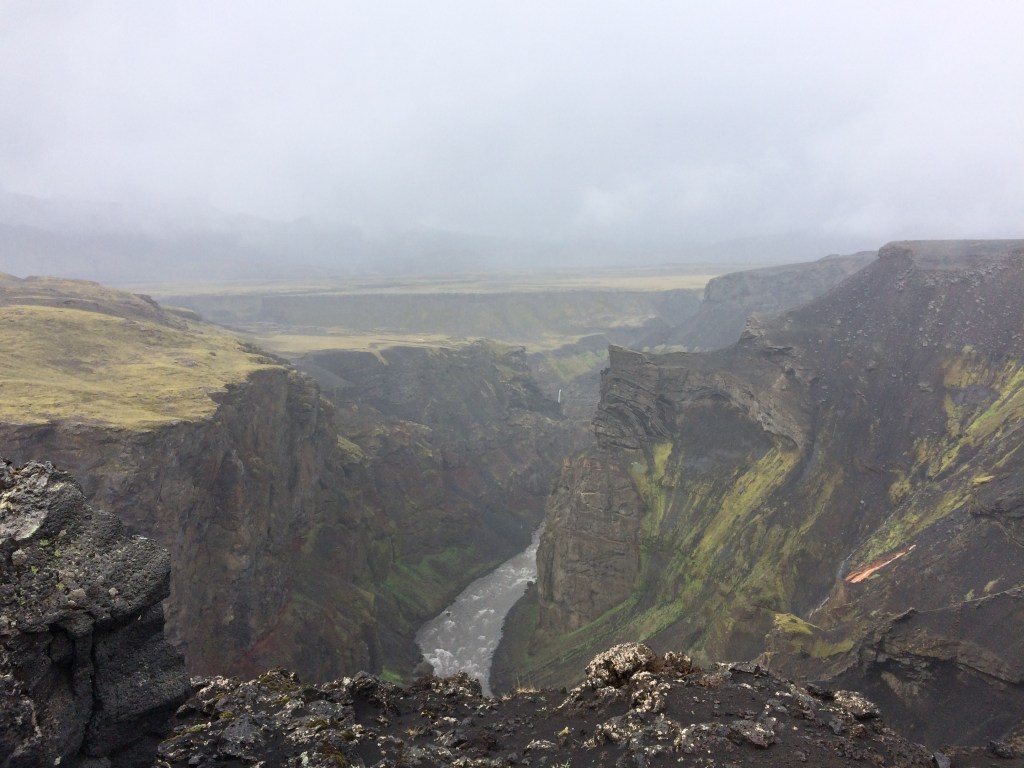
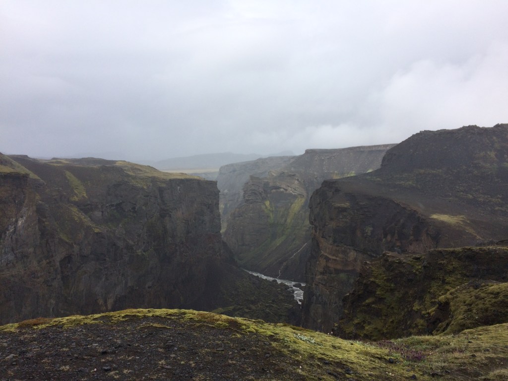
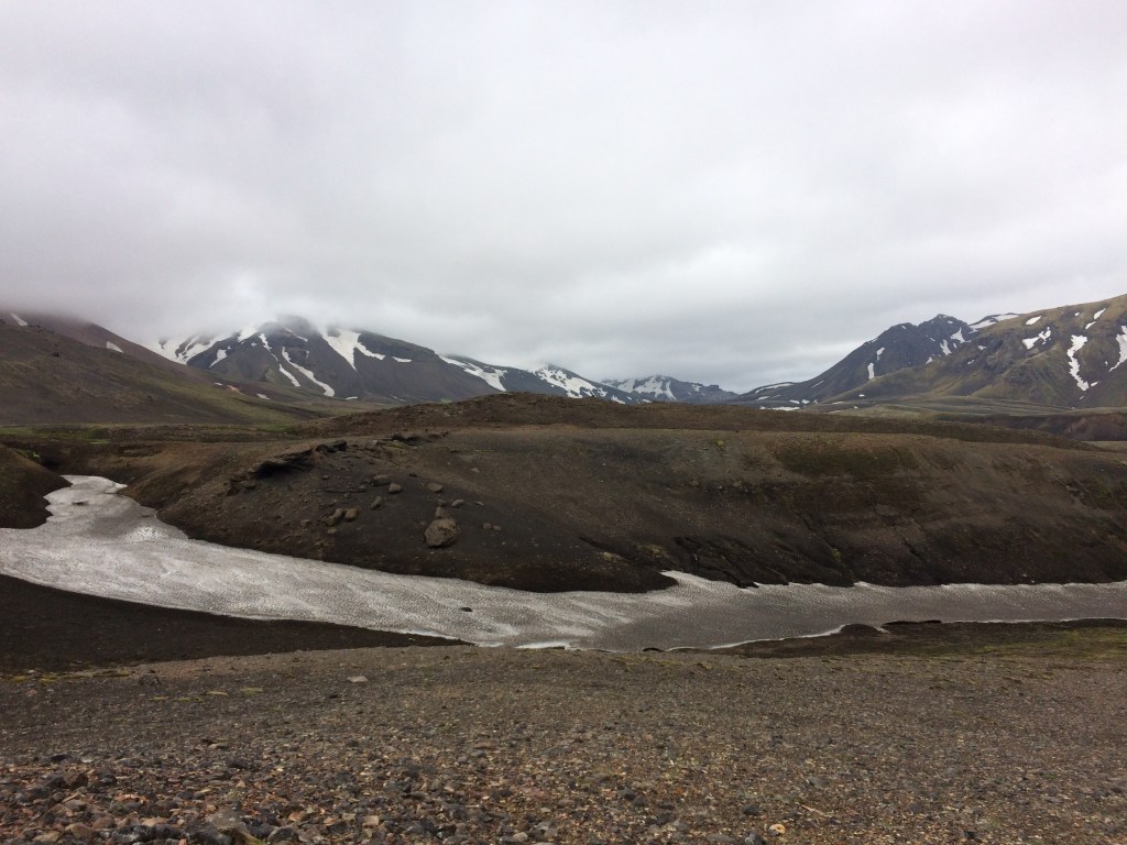
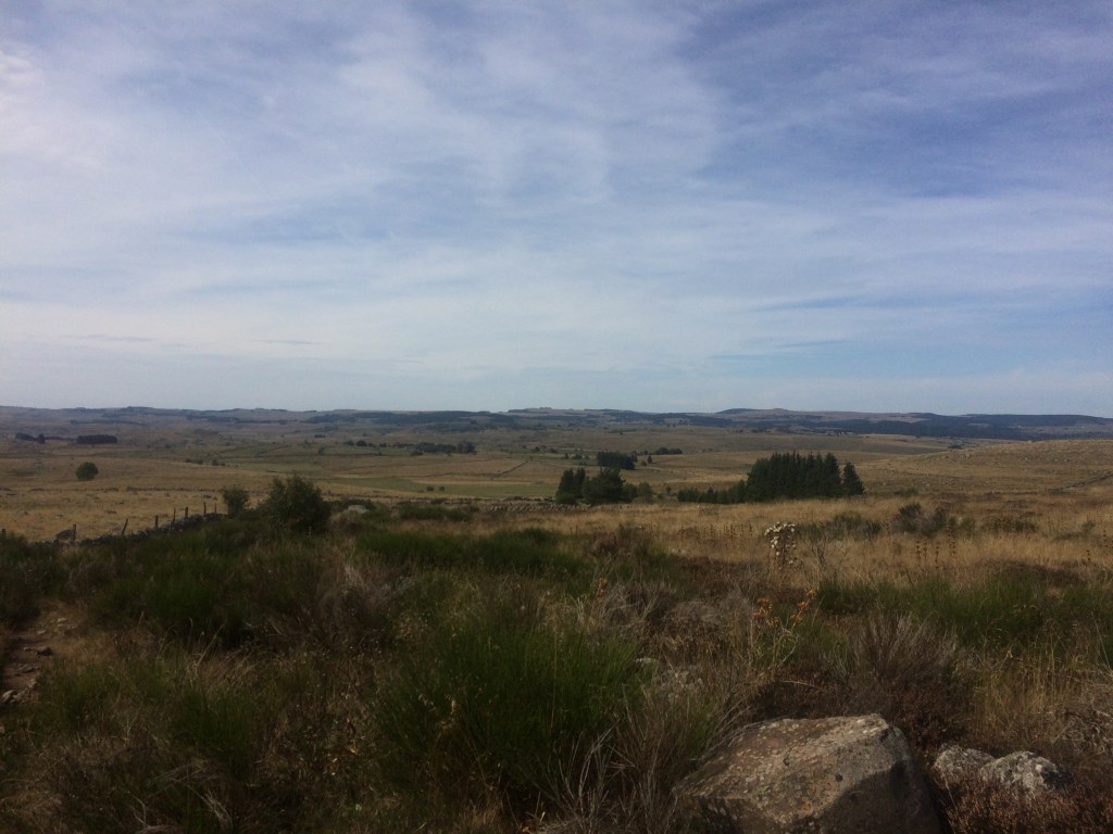
The highest elevation on the Aubrac plateau on this particular trail is the Roc des Loups and the views are commanding once one is at the top. I made sure I stopped and had some food etc before making the climb up here (plus there was the descent down the other side).

Roc des Loups

By comparing notes with some of the other hikers I heard that some hikers had stopping walking (and were either giving up completely or paying to be transported by road to their next stop). Reasons included severe foot blisters and on occasion insect stings (one has to be careful of wasps near the rotting fruit on the ground at times). This is a trail that one needs to have trained for otherwise the going can be tough or in some cases too tough. At this stage I was averaging 25km a day and realised that long training walks during the previous 3 months were paying off.

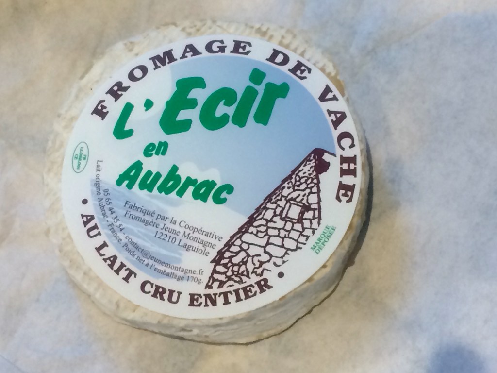
One evening meal was spent with other hikers in an eatery where the cheese course was passed around the restaurant on a large communal slate (and you could eat as much as you want)! Of course I also had the aligot during the main course as I am developing a major fondness for Cantal cheese and I needed to fuel up for another day.

Fromage de vache!

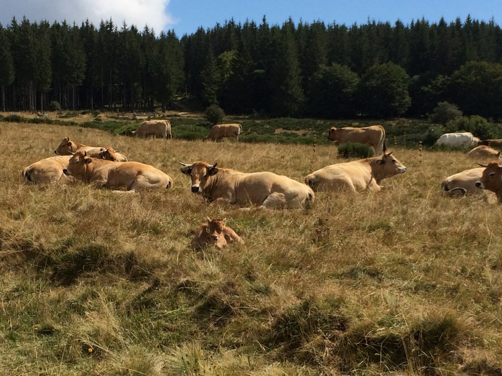
At times I found myself walking across farmland often with other hikers being visible ahead of me if it was still morning, opening and shutting the various farm gates as I went. There was always a quick hello, how are you exchanged-sometimes in English, sometimes in French-if I came across any hikers who have stopped for a break. On one occasion I came across two French farmers are guiding an Aubrac cow and her calf back to a farm building and of course I gave way!

Domaine D’Aubrac

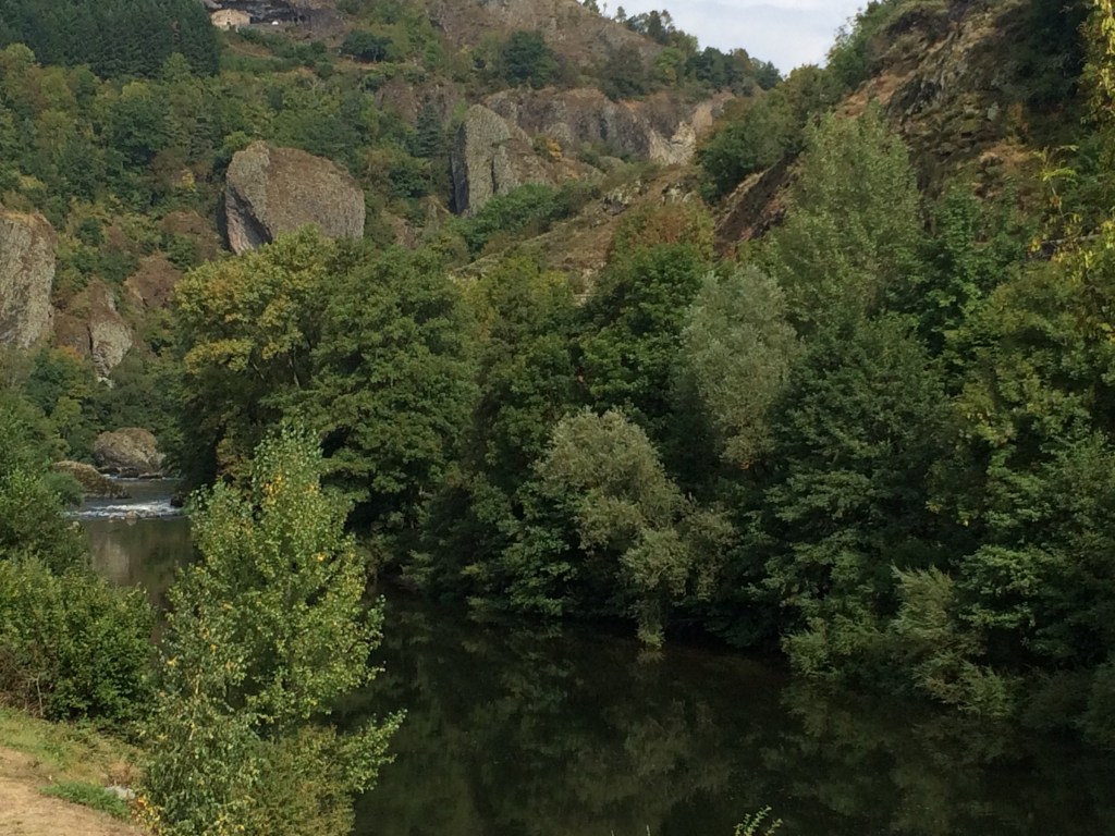
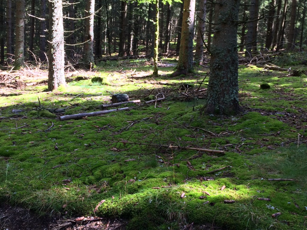
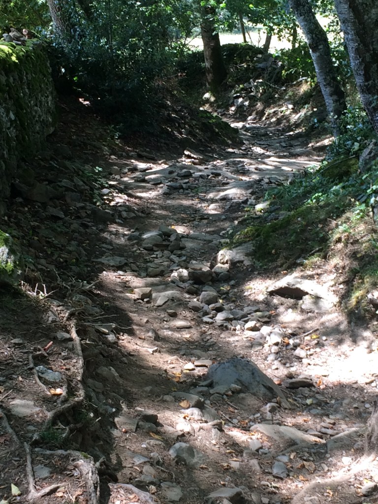
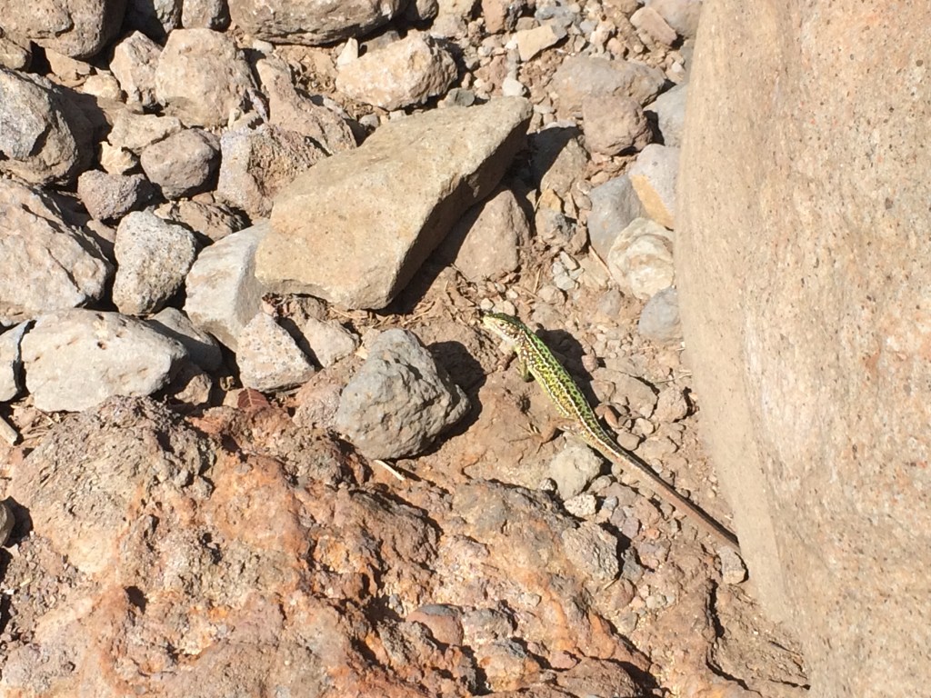
Descending from the Aubrac plateau takes one along what are predominantly rocky sections of the GR 65 through wooded areas towards the Lot Valley. I often had only European wall lizards for company during this particular stage and the bright green variety were rather magnificent to look at. Any low hanging fruit on the fruit trees was also a very much welcome addition to the snack regimen. As it was Autumn and the acorns were also dropping I was glad that I was wearing a wide brimmed hat because this way the acorns did not hit me in the face (and they do sting if they drop from a height)!

Hello Mr Lizard!

Yes the trail is predominantly rocky but it is a relief to be under shade at times. An image of this section of the descent into the Lot Valley can be found in my in initial post about the Via Podiensis https://debverranlivinglifeoutdoors.travel.blog/2019/11/06/tales-from-the-via-podiensis/

One village provided a welcome stop and a chance to buy food at a local store come boulangerie. It is always good to walk around and look at some of the old medieval architecture along with the original town well

Leau Potable, St Chely d”Aubrac

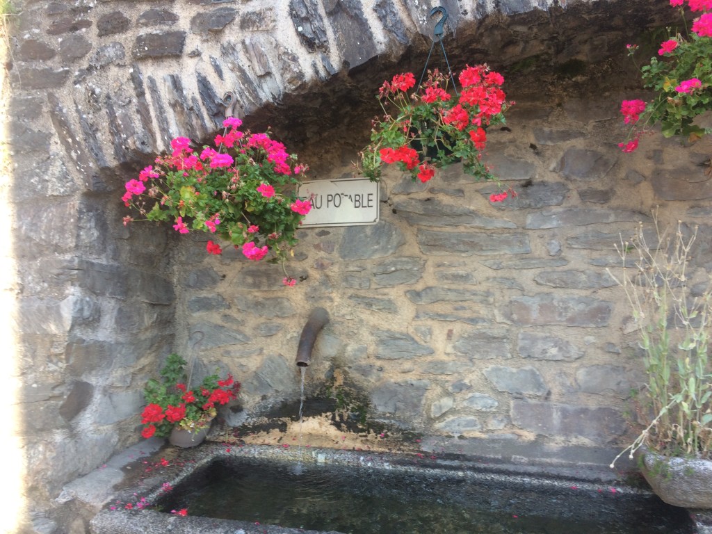
If water is potable then this is indicated by a sign, however not all water along the route is potable so if you want to avoid an upset stomach watch out for the signs!

To be continued: Tales from the Via Podiensis – c) From the Lozere into the Lot Valley of the Aveyron https://debverranlivinglifeoutdoors.travel.blog/2019/11/24/tales-from-the-viapodiensis-c-from-the-lozere-into-the-lot-valley-of-the-aveyron/

Tales from the Via Podiensis in France – A) Departing Le Puy

Even now I can recall my excitement at having arrived in Le Puy following a scenic trip on the train from St Etienne. I dropped my bags at the accommodation and set off to explore. This is when I first became familiar with the French 2 hour lunch break (with the shops all shutting down) and was lucky to grab some lunch at a local boulangerie just before the door closed. However, I could walk around and admire the sights including the Cathedrale Notre Dame and work out when to return to get my creancale stamped and also then tour the medieval cloisters

Heading up the steps of the Cathedrale Notre Dame le Puy en Velay

The morning of my departure I arose pre dawn, hence missing breakfast at the accommodation and headed for the Cathedrale for the pilgrims mass at 7 am. This is quite an experience and was well worth attending. It finished with us all singing a hymn and the cathedrale staff handing out small prayer books and pilgrim medallions to all of the walkers. On a quick show of hands about half of the gathered throng that morning were from France, with the rest coming from Europe, North America and Australia.

Off we all set and it was not long before everyone spaced out (nothing like a couple of hills to have this effect), due to the steady climb out of Le Puy. From then on it would be a series of hills, the odd village (complete with church which was often of a medieval vintage), and areas of farmland until the first nights accommodation.

On the GR 65 heading towards Saint Privat d’Allier

This was to be repeated over the next couple of days, except that there were now more wooded areas and the morning departures were at first light, with the landscape looking surreal in the mist. Foraging for fruit also became a morning ritual (to snack on during the day)! One highlight was stopping in a small village near a gorge for a break and watching as a rural butchers van motored in to ply its wares. It stopped outside of a nearby restaurant and the owner came out to do business. Then the owners dog appeared and ran around the van repeatedly in circles until the van driver threw it a piece of meat!

Gorge by Monistrol d’Allier

I found it worth stopping at the various churches along the way to marvel at the architecture and the stained glass windows. I found it difficult to photograph most of the windows due to the limited interior light. There were often small brochures or wall flyers inside these churches outlining some of the local history, plus some also had stamps available for the creancale. At the Chapelle St Roch I managed to have a short conversation with one of the locals who was sweeping the church floor, plus then have my creancale stamped. Two French tourists who turned up in a flash sports car also asked for a creancale stamp (for their map) but were denied -“You have to walk to get one” was the response in French from the local man (I could understand spoken French to some extent).

Chapelle St Roche, near La Roche

Following several hours of hill walking I would stop for a snack mid morning – it was taking some time during the early days on the trail to gauge how much food I actually needed. One morning I opted to stop in a side lane of a small village (mainly so that I could be away from the main road and put the backpack down). Some road walking is also required along the GR 65. I retrieved some snacks looked around and voila I now had two little ‘friends’ at my feet. Somehow I think they were very practised at this! Shortly afterwards another small farm dog followed another woman hiker for close to 5 km.

Les chiens!

Finding an area in woodland to stop for lunch was a high priority as it was often quite warm in the middle of the day, plus I was usually nowhere near a village (particularly one with shops that were also open). I was not alone in adopting this approach. If it was really warm and there was no shade to be found I would walk on until such a time that I could find a suitable place. Hydralyte (electrolyte replacement solution) was already becoming a mainstay along with keeping an eye out for potable water.

Woods near Chazeaux, Aubrac Region

There was the pealing of church bells from nearby villages and at times the tinkling of farm bells from the sheep or cattle in nearby fields. At times there were chickens running around (always near a farm yard) and it was not uncommon to see also farm cats most of whom were wary of strangers. Then there were the gorgeous coloured butterflies every now and then, because there were still some flowers around. I was never successful in snapping any photos of the butterflies, nor of the crickets and grass hoppers who would all be chirping with gusto by mid afternoon in the nearby fields. I saw the occasional very large native French snail and thought that I would have plenty of opportunities to get a photo later on during my travels along the GR 65. Unfortunately this was to prove to not be the case.

I never thought that I would get up close and personal with the cattle but in fact this happened on several occasions. Fortunately the magnificent Aubrac cattle seemed quite used to seeing hikers walk by as they rested chewing their cud whilst keeping a watchful eye out! The calves were also quite cute but the local advice was to not ever get between one and its mother!!! This meant that on one occasion I had to detour off the trail as there was an Aubrac calf sleeping slap bang across it. One look at those horns on all of the adult females and it is okay ….. I will detour.

Aubrac cattle

Even better was some of the cheese that was made from the milk of these magnificent cattle or the aligot that was served up some nights. Being a fan of French cheese this was a major plus, because it already seemed that wherever you ate at night most of the time it was local produce that was being served. If there was enough time at the end of the day there was always other sights to look at if staying in a village or small town.

Aigle de Saint Jean, in the Saint Medard Eglise in Saugues

To be continued: Tales from the Via Podiensis -B) Traversing the Aubrac Plateau https://debverranlivinglifeoutdoors.travel.blog/2019/11/16/tales-from-the-via-podiensis-b-traversing-the-aubrac-plateau/

Tales from the Via Podiensis

Having walked along the Via Podiensis in France in 2018, I have wondered ever since whether I could encapsulate my journey into a series of blog posts. This is not as easy as some of you may think because each day on the route brought with it a myriad of new experiences, from the time that I left Le Puy until I arrived in Saint Jean Pied de Porte nearly 5 weeks later .

Rocher Saint Michel D’Aiguihle, Le Puy en Velay

Rather than blog in real time (which I felt would detract from my time on the route), I have waited until I felt that I could write in a more entertaining manner. What this is not going to be is another blog of what to expect each day on the route, i.e, if you walk from A to B, then you will pass this and see that and so on and so on. One can find other blogs composed in this manner.

On the GR 65 about to walk down into Saugues

So instead I have organised my thoughts into Chapters each encompassing a segment of the journey and containing stories of some of my experiences which really stand out.

Morning mist on the outskirts of Condom

Whether it be the food, the company, the wildlife, the farm animals, or the Medieval architecture there are plenty of stories.

Eglise Saint Barthelemy, Lauzerte

There is also the scenery ranging from forests to barren plateaus as well as small villages and towns dotted along the route to the Pyrenees. Except for the other hikers and at times vehicles, there are long silences punctuated by the sounds of either the ringing or tinkling of bells.

Garonne Valley

There are the rocks (on the trail), the ever present hills and at times extremely warm weather.

En route to Saint Chely d’Aubrac, mind the rocks!

Plus there are a steady stream of reminders along the way (signs, crosses, trail markers) as to why this route is also known as the Chemin de Saint Jacques. So there is much to write about and a series of posts will follow.

To be continued – Tales from the Via Podiensis – A) Leaving Le Puy and heading out along the GR 65 https://debverranlivinglifeoutdoors.travel.blog/2019/11/10/tales-from-the-via-podiensis-in-france-a-departing-le-puy/

Trekking in Iceland- the Fimmvorouhals Route – Fimmvorduskali Hut to Skogar

After close to a solid 10 hours of sleep punctuated by one trip to the unisex latrine (which mercifully is not outside), I awaken to peer out the hut window to see the same misty surrounds as the evening before. In fact the visibility is so limited that I do not even entertain going outside because there is not much of a view. Others stir and soon after 7 am Solvi (our guide) starts preparing the porridge and coffee. Having seen the weather outside, I decide that I need extra energy for todays trek so during breakfast I stir squares of dark chocolate into my porridge!

We sort out our gear and pack it into our backpacks then put on our outer gear, boot up and head out. There is now light misty rain so I snap a couple of photos. Thephone battery is close to dead and as I did not carry the portable charger there is nothing that can be done at this stage to fix it!

I manage to take a picture of the Fimmvorduskali hut (being careful to not step off the path!).

Fimmvorduskali Alpine Hut

Then I turn around and take a photo of the nearby terrain as the hut resides up on the top of a ridge. This is the visibility that we will have for the initial descent down off the ridge!

Fimmvorduskali hut ridge top view

Then off we set trekking across snow and at times rocks for the initial part of the descent towards Skogar. The first of what will be many waterfalls is spotted by Solvi (our guide) and we peer at it through the misty rain. A couple of better equipped members of the group stop to take photos.

Onwards we head. At one stage as I am at the front of the rear group of trekkers I spot what seems to be a bird shaped rock in the misty rain. As I get closer I think to myself what an interesting shaped rock (amongst the numerous rocks for the first couple of hours). It is not until I am 100 metres away that I realise that I am looking at a Ptarmigan which is so perfectly camouflaged against the rock that it is perched upon that they both look to be the same colour. I point it out to the other trekkers but sadly I cannot take a photo!

We trek past numerous unnamed waterfalls each appearing a little more magnificent than the past. We also cross a bridge over a narrow gorge with a fast flowing river (a tributary to the main Skogar river that the Fimmvorouhals trail runs in parallel to for most of its course). The planned for lunch stop in the one hut on the trail is thwarted by the hut not being open! So we break for lunch on a scenic spot sheltering behind rocks. However lunch is a short affair as several members of the group are beginning to feel the chill (due to the rain). So off we set again with just a quick stop for each waterfall to admire the view! Of note most of these waterfalls are still unnamed. At one stage I am trekking up another incline in the mist and I see an Iceland Raven. Quite a large bird, completely jet black in colour (and unfortunately I am not able to photograph it ….. sigh)!

Finally we know when we are getting near to Skogar and the infamous Skogarfoss waterfall because the number of other people on the trail now increases quite dramatically each kilometre. In addition the mud underfoot on the trail has also increased-which provides its own challenges.

Noting can prepare you for the magnificence of the Skogarfoss waterfall, nor the sound of the water rushing over the top and then pouring down the sheer drop into the valley below. On reaching the top viewing platform I manage to snap one image of the waterfall just before my digital phone battery dies for the day. The small white objects dotted around the vegetation are nesting Arctic fulmars.

Top of the Skogarfoss waterfall

Then it is perhaps the most difficult part of the day, descending down a very steep set of stairs in damp conditions into the valley below. Some of us take our time because one slip and well it is not worth thinking about. Then the group reconvene with Solvi and trek to the base of the Skogarfoss waterfall. The thundering sound and forces of the descending water along combines to creates it’s own micro climate at the base of the waterfall. You can feel the force of the water hitting the small lake at the bottom and see the waves travelling across the lake surface. We gather for a group shot for which Solvi then obliges. I guess when you have guided a group of trekkers for the last week over all sorts of terrain, through all types of weather it is pretty exciting to reach the end-hence the Solvi photobomb. Needless to say we are not worried about getting wet from the spray of the waterfall because by that stage we were already wet!

A relieved trekking group at the base of the Skogarfoss waterfall

As soon as we have had our fill of the majestic sight of Skogarfoss we head off to one of the nearby facilities to shed our wet outer gear, have a warm drink and get ready to board the bus back to Reykjavik. Like for any other multi day trek there is a sense of accomplishment and also the relief to have made it unscathed! The memories will last for a lifetime. The lack of photo opportunities on the last day were partly from a combination of bad luck due to the weather and not wanting to carry the additional weight (of a portable battery) in the backpack. Ces’t la vie.

Should you ever want to go trekking and hiking in Iceland the motto is to be prepared and the following is some of the advice put out by Safe Travel Iceland. Their website is very much worth looking at

So that is it for this trek. So long for now until I post about my next hiking/trekking adventure

The Fimmvorouhals Trail in Iceland: Langidalur to Fimmvorduskali mountain hut

After a solid 8 hours sleep I slip out into the brilliant morning sun and gaze at the nearby scenery including the magnificent Eyjafjallajökull glacier. The local bird life are already frenetically busy for the day (there is a lot of chirping going on nearby). My legs have recovered from the rigors of the Laugavegur trail and I am optimistic that the 1000 metre climb later today will not be an issue. As others stir, I start packing the gear that I don’t need for the next 2 days into a duffle bag which I will not see until Skogar. Everything else for the next 2 days then goes into the backpack.

We all assemble in the downstairs dining room for breakfast. In view of the climb I have porridge with Granola mixed into it for the extra energy. Then we each make our sandwiches for the next two days (which also go into our backpacks). We then help Solvi (our guide), carry items down to the pick up area for the bus service as all extra food and gear are to be transported out of the area. The sun is out and I am hoping that it will stay this way.

Of we set, walking along the Krossa valley, where we initially cross a river tributary via a small wooden bridge. Mercifully there is a larger metal bridge that has been swung into place across the main river channel which we can then all cross. This takes us to the path leading to the Fimmvorouhals trailhead.

Bridge crossing over the Krossa River

The climb commences initially through patchy birch forest and then up across the first couple of ridges. I am able to look back at times along the Strakagil canyon towards Langidalur (see below), with the Eyjafjallajökull glacier to the left and Valahnuker in the distance across the river valley.

The Strakagil Canyon with the Krossa river valley in the distance

Once we are predominantly above the tree line the climb becomes a bit more technical with the requirement to hold onto either fixed ropes or chains at times. I do not even try and take a photo of the narrow Kattarhyggir ridge (with the sheer drop on either side) as we cross. Safety comes ahead of photos!

Taking one step at a time along the trail

There have also been some great views of the Myrdalsjokull glacier as we ascend, but the cloud is steadily increasing!

Myrdalsjokull glacier

Finally we reach a small plateau known as the Morinsheidi flats, from which there is another great view of the Myrdalsjokull glacier. However the sun is beginning to vanish behind the clouds and the wind is now really blowing! There have been lives lost on this trail (mainly due to people being ill equipped for the weather and pushing on in poor conditions). At one stage we pass a poignant memorial.

Up on the Morinsheidi flats with Myrdalsjokull in the background

In fact by this stage the wind is blowing so much that I have had to put on all of my outer wind shell gear and a woollen beanie! You can see the mossy lichen behind me on the ground (it is like sponge), which you have to avoid treading on!

We head on a little further until we stop for lunch on what would normally be a great spot with a spectacular view. However the wind chill is so bad that most of us spend our time either crouching/sheltering behind the larger rocks! So lunch is a very brief affair, with sandwiches and coffee being consumed rapidly.

Not long after leaving our lunch spot we are at the base of the Godahraun lava field (from the first eruption of Eyjafjallajökull in 2010). I look up, and yes this is what we are about to climb (see below)!!! Somehow this picture does not quite do justice to the height of the lava bed. Solvi spends some time explaining about this particular eruption before briefing us about the climb. The first ridge is known as Heljarkambur where there are some tricky narrow sections to the trail (with chains to hold onto!).

The cloud has rolled in and the wind is blowing off the nearby glaciers so in preparation for the next climb, on goes the neck gaiter. If it gets any worse the sun glasses will have to be replaced by the snow goggles!

Following a slow technical climb up the face of the lava bed punctuated only by the odd trekker descending in the opposite direction, we reach the top. The glaciers on each side are now obscured by the low cloud ceiling but once over the ridge top there are the two volcanic cones from the first 2010 eruptiom of Eyjafjallajokull to explore. These are Magni (on the left) and Modi (on the right), named after the sons of Thor.

Magni and Modi

We head off and climb up the smaller Modi which is composed of loose coarse volcanic rock, followed by trekking nearby to look at some of the nearby exposed lava. In the distance looking back across the rugged lava field the Tindfjallajokull glacier and nearby mountain peaks can just be seen. This is the only glacier not obscured by cloud by this stage!

The Godahraun lava field with Tindfjallajokull in the distance

Then we head across to the second volcanic cone (Magni) and climb to the top where the views are now extremely limited by the misty cloud. So down the other side we go (being careful not to slip on the loose gravelly sharp volcanic rock). My digital phone battery supply is rapidly dwindling (largely due to the wind chill), so that is it for photos at this stage.

We trek on and then have to veer off the Fimmvorouhals route in order to reach the Fimmvorduskali hut. Most of this part of the journey involves trekking across snow, after 1000 metres of climbing! We have split mainly into two groups by this stage, the faster walkers at the front and the slower ones bringing up the rear. I stick with the rear group as it is important for both visibility and safety to stay together! There are other people on the trail even at this stage and you hope that they can either find shelter for the night or are able to trek on to a trailhead.

We finally reach the hut and are warmly greeted by Bjork the hut warden for the week, who has made sure that it is nice and warm inside. So it is off with the damp gear and boots in the vestibule and then we arrange ourselves inside the compact main room of the hut around the table. Water has been on the boil for a hot drink and we can have a welcome snack. Solvi sets about organising what is for dinner (it will be rehydrates dried camping food along with tinned ham). This hut is resupplied at the beginning of the season and involves specially equipped alpine terrain vehicles being brought up the mountain!!!

After dinner we hear about what it is like to be a hut warden and how the emergency services would respond if someone broke a leg (which is good to know!). There are no views to be had because outside it continues to be heavy white mist and this has been like this since we arrived. I pull out my sleeping bag liner and pillow out of my back pack, rearrange some gear an turn in for the night (not that there will be any darkness)!

Not long after this we all turn in, it is fair to say that 1000 metres of climbing has led to some tiredness!

To be continued: The Fimmvorouhals Route Iceland – Fimmvorduskali Hut to Skogar

Trekking in Iceland – Day 5: Langidalur and nearby Porsmork

After a more restful night I sneak out of the bunk room, go down the stairs of the hut and head outside. There are no views of the nearby mountains due to the low cloud ceiling but the nearby birds have already launched into action for the day. I spot some of the smaller birds including redwings and a couple of white wagtails, who are all on the move. Life is frenetic if you are a migratory bird in Iceland for the summer! Once it is 7 am there is a hive of activity in the kitchen with two of the other hiking groups preparing and then tucking into breakfast. These are the hikers who have to head out early for the day. We can wait a bit longer this morning as we will be staying in this hut for another night and hence limiting our trekking to the nearby region.

I revisit the previous 4 days spent on the Laugavegur trail as it is well depicted on one of the signs outside of the main hut, as pictured below. I can visualise all of the mountain peaks that I trekked by (some of which were not visible at the time). Breakfast is the usual porridge and strong coffee along with bread and butter. As we will only head off for 3-4 hours of trekking today there is no need to pack a lunch.

The Laugevegur Trail

We set off for a short trek up nearby Mount Valahnuker, with Solvi (our guide), leading the way. Initially we ascend through a patch of birch forest before the vegetation begins to rapidly thin out. Some alpine orchids are spotted and this distracts the members of the group who are into taking photos of the vegetation. So what is better than one alpine orchid? Two different types of alpine orchids!

Onwards and upwards we head until we are at the top of Mount Valahnuker. The hoped for views of the nearby glaciers are nixed by the cloud cover, but the views of the nearby valleys with the glacier fed rivers are worth it. Below on the left had side is the Krossa river, in which 4 wheel drive vehicles get trapped weekly during the summer, usually when inexperienced drivers take risks! Solvi has stories to tell about these types of vehicle mishaps as well. Hint, they are very expensive if you are the driver.

Then it is time for a group shot as we all stand on a nearby buttress

Ridge top group photo

After a fairly rapid decsent we find ourselves at the Volcano huts complex over in a nearby valley. The Volcano huts are a bit more salubrious as they also cater for day trippers to the area. It is discovered that there is Wifi, so a couple of quick messages are sent to family and friends, to basically say that I am alive and well. We meet two new trekkers who are joining the group for the next couple of days for the forthcoming Fimmvorouhals trek.

Mercifully we do not need to repeat our mornings journey up and over Mount Valahnuker but instead we follow a trail though the forested region of Porsmork back to Langidalur. By this stage the sun has come out so the outer gear can be discarded. The colours of the flowers along with the vibrant undergrowth are really brought out by the added light. What is not captured by the photos are the sounds made by the numerous small birds who have made this region their home during summer.

Husadalur woods Porsmork
Floral undergrowth in forest in Porsmork

Once back at the Langidalur hut complex we have to farewell 5 members of the group who will be departing on the bus back to Reykjavik. So everyone takes it in turn to say their goodbyes. Solvi (our guide) has ensured that flat bread, cheese and smoked salmon are available for sandwiches. For those of us who are remaining we can actually enjoy being outside and marvelling at the nearby mountain scenery for the rest of the day.

I take the opportunity to wash the most offensive items of clothing as there is an outside washing line (and the sun is out). The rest of the afternoon is spent either in the sun or strolling around the nearby region. Towards the evening when there is finally not a cloud in the sky a number of light aircraft then appear, flying along the nearby valley and around the Eyjafjallajokull glacier, which is looking simply magnificent in the sun. You cannot get too much of this view!

Eyjafjallajokull in the late afternoon sun

As the light is so good I also take the opportunity to snap a photo of the Myrdalsjokull glacier at the head of the nearby valley. Such lovely bright blue sky! All the time I am hoping that the weather will be like this tomorrow. The first part of the Fimmvorouhals trek will take us along this valley towards the trail head in the direction of the glacier.

Dinner is meat cooked up akin to spaghetti bolognaise and then a magnificent cheesecake made in the largest bowl in the hut complex. We devour it all as we have to climb 1000 metres to reach an Alpine hut at the top of a pass tomorrow. It is still bright sunlight as we all retire. A couple of my fellow trekkers opt to stay up to view the midnight sky twilight but I prefer to sleep.

To be continued: Trekking in Iceland – Fimmvorouhals Route : Day 1

Trekking the Laugavegur Trail Iceland – Day 4: Emstrur to Langidalur

After a restless night, mainly due to us all being so close together on mattresses on the bunks in the small mountain hut, I head outside early to look at the surrounding scenery. The cloud ceiling has dropped again overnight so the views are limited, but one added bonus is that it feels slightly warmer. I also take the opportunity to stretch my thighs and limber up (as my right thigh is still not right from being corked 2 days prior, but at least it has not got any worse).

Then once it is 6am other members of the group begin to stir and shortly afterwards the packing up of sleeping bags and the sorting of gear begins. This is followed by activity in the kitchen with breakfast being served-the usual porridge and coffee supplemented by bread with butter or Nutella in some cases. Then we all make our sandwiches and the kitchen team cleans up (which involves me as I am a member of the kitchen team today). As soon as everyone is organised and the duffle bags have been loaded into the transport vehicle it is time to depart. I will have to carry one of the coffee thermoses this morning (some additional weight in the backpack)!

Off we set across black volcanic sand until we descend towards a nearby gorge with the Fremri-Emstrua river at its base. The tops of all of the mountains remain obscured at this stage. There are chains that you can hold onto on this part of the trail (an added safety measure for the trickier parts which are on uneven rock). You do not want to slip!

Heading down towards the Fremri-Emstrua River

Crossing the Fremri-Emstrua river is straight forward as it is via a bridge and we then walk alongside it before we head up again across more volcanic sand and rock. The cloud ceiling remains low and we seem to be just beneath it at times.

The Femri-Emstrur River and surrounding scenery

Further on we trek over another ridge and lo and behold there is a small stream with some vegetation around it (not just the usual moss and lichen). This is an opportunity to have a short stop and for everyone to regroup before the next hill climb! For the photographers there is the opportunity for some macro shots of the unusual vegetation (plus we are out of the wind). The large light green bushes with flower heads on them are Angelica.

Then it is another short climb up towards the rim of the Markarfljotsgljufur gorge where there is the opportunity to look down at the fast flowing Markarfljot river at its base. Our guide (Solvi) reminds us to be careful near the rim as our personal safety is paramount. Hence we are directed towards the safest viewing spots.

Peering down into the Markafljotsgljufur gorge

Shortly afterwards we stop for a coffee and a snack break and I am able to hand over the thermos (my stint of thermos carrying is over for the day). Woohoo less weight in the backpack! We trek further along the trail which runs parallel to the gorge and marvel at the volcanic scenery.

Further on we come across a stretch of volcanic sand littered with large rocks. These are lava bombs which have been thrown out of one of the nearby volcanos back in time. This precipitates a discussion about what would happen if there was a sudden volcanic eruption. Apparently there is an emergency response plan for this region, which involves hut wardens sending up fireworks/flares into the sky and the trekking guides also being notified. You would then be advised to immediately head in the recommended direction (and hopefully avoid a direct hit from any lava bombs)! This is something that I hope not to experience this trip.

Looking back over the volcanic sand and a lava bomb

The low cloud cover has limited our views of the summits of the nearby mountains but then as the cloud lifts (and we begin to descend again), there is a brief glimpse of the Myrdalsjokull glacier, as the Laugavegur trail runs in parallel to the west of it for this particular segment. There are now some better views to be had of the nearby hills which are covered in moss and lichen. Hence the green!

We then trek over another ridge into a small gulley by a stream. As this spot is out of the wind, we can stop for lunch. Out come the sandwiches and plastic mugs (for the coffee!). There are rules to be followed with respect to bathroom stops (always downstream). There are a number of clumps of flowers and other interesting sub alpine vegetation including Crowberry and Bilberry plants which provide a marked change from the green moss and lichen. The dark purple flowers in the following image are Bartsia.

Sub alpine floral scenery

Then after another short climb we start heading progressively down along a spur towards a large river. This is where we see the first signs of different vegetation and hear the chirping of small birds in some nearby scattered clumps of bushes. After several days of hearing only the sound that we make (and that of the wind), this chirping is music to the ears. As we descend further and the cloud clears, I can see the infamous Eyjafjallajokull glacier for the first time with the Pronga river down in the valley in the distance.

Glimpsing Eyjafjallajökull amongst the clouds

Down the ridge we descend until we come to a gulley where there are some birch trees. This is a welcome stopping point for a rest and a drink, and is known as the Kapa region. It is nice to sit down on some grass but the flies are a real nuisance! We then move off and cross the bridge over the Ljosa River and head up yet another ridge. This is where I take the opportunity to look back and snap a photo of the Kapa valley.

The Kapa region

We cross over the ridge and then descend towards the Pronga River, where it is off boots on sandals followed by a wade through the cold water to get to the other side. We then climb a ridge the other side of the river towards our destination for the night and are rewarded with commanding 360 degree views of our surrounds. This is the best view so far all day of the Tindfjoll peaks (Ymir and Yma) along with the Tindfjallajokull glacier

TheTindfjoll peaks looking across

Looking towards our final destination for the day I can see the nearby wooded region of Porsmork with Eyjafjallajökull looming up behind it. This greenery resembles what the lower elevations of Iceland looked like prior to human habitation. We will walk through part of this birch forest before we reach Langidalur.

The wooded region of Porsmork with Eyjafjallajökull in the distance

Finally the group reaches the huts at Langidalur and this seems like luxury accommodation compared to the previous 3 nights. We are accommodated in one half of a large spacious loft upstairs and hence we can spread out. Plus there are showers which are out of the wind! So everyone immediately claims a space in the loft, gear is sorted and the queuing for showers commences.

We also have a quick hot drink and a snack before Solvi provides instructions to those of us who on the kitchen team. I along with 3 of my fellow trekkers have to make a salad as well as cook Icelandic style fried potatoes and onions. Because we are cooking for 16 this involves using the industrial sized cooking pots on gas rings in the kitchen. First a small mountain of potatoes and onions are peeled and diced (two of the men do this-thanks guys), but the hut kitchen knives are blunt …… oh noooo! We manage to persuade the cook for another trekking group to loan us his large highly sharpened kitchen knife (after we watched him sharpening it). This other cook (who was also the Guide for another trekking group) was a real wiz at dicing and slicing (fortunately this was not a competition)! We then found out that he had previously been a chef in a restaurant back in time, which explained alot!

An industrial pot of water containing the sliced potatoes then had to be brought to the boil for 5 minutes. Then said potatoes and onions were fried in an industrial sized frypan (I was the head chef for this particular task), with care being taken not to burn them because16 hungry people are waiting!!! Dinner was then served and also included Icelandic lamb cooked on a barbecue outside. This is the last night that we will all be together. The evening is then spent partly outside enjoying the scenery as well as comparing notes and swapping stories before we all turn in.

To be continued: Trekking in Iceland – Day 5: Langidalur and Porsmork

Trekking the Laugavegur Trail in Iceland – Day 3 : Alftavatn to Emstrur

I am up early because basically it is daylight, and there are the dulcet tones of snoring reverberating around the hut. So I head out to the shower block and find that I am not alone in having a quick face wash etc at the sink. It is cloudy and the wind is blowing but it is possible to glimpse mountains in the distance. More importantly, it is not raining! I also realise that I have a mildly corked right thigh (from the descent off the Caldera in harsh conditions the previous day). How I will get on during todays trek now remains to be seen!

Lake Alftavatn vista first thing in the morning

The morning routine from the previous day is repeated once it is 6 am, which includes packing unwanted items and sleeping gear into the duffle bag which will be transported. Outer gear snacks and the all important plastic cup are placed into the back pack. As soon as it is 7 am there is activity in the kitchen where Solvi (our guide) and his helpers fire up the gas burners for porridge along with hot water for the coffee. Meanwhile I stretch my legs and loosen up as much as possible despite the pulling in my corked thigh!

We all sit down for breakfast and then it is sandwich making time (I focus on cheese, tomato and cucumber). Once everything is tidied up there is a final briefing about what we can expect (today there are a number of water crossings) and then off we set.

Up over the Bratthals ridge we head and then follow an F road for a short distance. At this stage there is a glimpse of blue sky and there is the first sighting of the Myrdalsjokull glacier. I am hoping that today will be the day that the cloud rolls back so that we can see even more of the spectacular scenery. At this stage it looks promising.

Myrdalsjokull Glacier in the distance

Down the side of the ridge we head towards the Bratthalskvisl River which now has to be crossed. My right thigh twinges at times so it is short strides, combined with optimising the use of my trekking poles. This is where ones river crossing skills are put to the test (after the most appropriate location has been selected). So it is off boots, roll up trousers and on sandals. The back pack harness straps are left unclipped (so that it can be ditched in the event of a fall into the river to avoid being dragged under by the weight).

It only takes a couple of steps to appreciate how cold the water is (foot numbing), so this is a major incentive to get across as quickly as possible! However, foot placement is critical on the river bed to prevent slipping. Once on the opposite bank it is off sandals, dry the feet and legs and on boots (this is to be repeated later in the day).

We set off over another ridge with more in the way of greenery from both the lichens and moss being visible, followed by another descent. I am a bit slower on the downhill sections but this cannot be helped (if I want to complete this trek I have to nurse my right thigh)! Eventually we rest for a short while at the Hvanngil huts before pushing on across a barren region, littered with rocks. Solvi tells us yet another story of people who have lost their lives in this region whilst travelling along this way. Then there is another river which is deeper!! So the additional precaution of crossing it in pairs is required (for stability against the current). By this stage the damp mist has descended again and the wind is blowing!!! I cross with one arm locked with that of one of my fellow trekkers whilst Solvi watches vigilantly over every pair crossing from the group (as in the below photo). Rapid action would have been required if anyone had tumbled into the water, because hypothermia is a significant risk in these conditions.

River crossing day 3

I sit down to take my sandals off, dry my legs and get my boots back on. My feet are white from the cold (& numb!!!). This fortunately only lasts several minutes as the circulation returns (and my toes mercifully pink up again). Solvi breaks out the coffee and chocolate and we then have a short break to ensure that everyone has recovered from the crossing and feels able to continue.

Onwards we head, by which stage there is now misty rain. Lunch is to be near the fast flowing Kaldaklofskvisl River, which we mercifully cross first via a bridge, as it would be far too dangerous to cross any other way! This bridge was a significant enabling factor in the Laugavegur trail becoming established as a trekking route. Nearby there is also a large rock which we can use to shelter from the wind. At this stage we are surrounded by rocks (again). The mountains are mainly obscured by cloud (sigh)!

Churning water in the Kaldaklovfskvisl River

Following lunch we trek across the region known as the Maelifellsandur black sands. This is when sand seems to start getting on everything (something to remember if you want to trek this trail in fine weather-you may need gaiters). The low cloud ceiling obscures the higher mountain tops including the peak of the nearby Hatfell volcano. Mid afternoon we stop for the obligatory break in a gulley out of the wind. Solvi promises us that he has something special to show us (so we all keep our hopes up despite the low cloud!). Onwards we trek over more sand and then rocks of varying sizes. We are now up on a ridge and Solvi is saying, not long now. All of a sudden we head down around a corner and up a small rise and there is the magnificent Markafljotsgljufur gorge with the Markarfljot river at the base. The cloud lifts a little although there are still patches of misty rain. Out come the cameras!

Markafljotsgljufur Gorge

We trek alongside this gorge until we reach another viewing point. There are some birds flying around (Arctic fulmars, which are nesting on the walls of the gorge), and with there also being a hint of sunlight it is simply a magnificent view.

After multiple photo opportunities and marvelling at the gorge we then head up over our last ridge for the day and are greeted by the sight of the Emstrur huts the other side. Our group is to be accommodated in one of the huts but it will be a tight squeeze (two to a mattress again)! Following the usual discarding of wet gear, sorting out of bedding and a warm drink, most of us opt for the 5 minute hot shower in the nearby amenities hut. This is a test of ones organisation skills! As the Emstrur huts are out of the wind (as they are located down the side of a ridge), the conditions outside are far better than the previous 2 nights. However the low cloud ceiling limits photo opportunities.

The kitchen crew sets about cooking dinner in a very small space, and the main course (which is salmon), is cooked outside on a barbecue. Following dinner Solvi gets his maps out and show us where we have been and where we are heading the next day. We also receive some additional information about the local volcanic geology as well as the nearby glaciers. Not long after this we all turn in. Of course there is no darkness!

To be continued : Trekking the Laugavegur Trail in Iceland – Day 4: Emstrur to Langidalur

Trekking the Laugavegur Trail in Iceland – Day 2 : Hrafntinnusker to Alftavatn Lake

Sleep is to prove elusive due to the snoring in the bunk chamber through the so called night which has also rendered my head lamp redundant for this trip. A trip to the latrines is made in what seems daylight but as the thick cloud continues to obscure the sky it is hard to tell where the sun is. After enduring the cold I return to my sleeping bag, being careful to not wake my fellow companion on the same bunk.

By 5 am I have decided to change into my clothes after a short visit for a face wash etc in the outside sink (the cold really focuses my attention to the task at hand). By this stage the wind is really blowing and the sky is even more heavily overcast. Also the temperature is a lot lower! So with some careful shielding of the smart phone I take a couple of photos of the scenery.

Looking out west across the camp ground (where there is as yet no sign of activity), there is a good view of the Reykjafjoll Mountain (the two peaks in the photo).

View of the Hrafntinnusker camp ground and nearby mountains

Turning to look south (where we have to head on todays journey), one can see a number of mountains, including the Haskerdingur peak (largely obscured by cloud).

By 6 am my fellow trekkers begin to stir. Clothes are changed inside sleeping bags (or around corners), followed by belongings being sorted. I roll up and place into their respective stuff sacks my sleeping bag, liner and pillow, then pack the duffle bag. Snacks are put into the back pack along with one winter weight middle layer top and the water bottle is filled. All of my other winter gear is left out (because the weather conditions are steadily deteriorating as the cloud ceiling is now dropping).

Breakfast is strong coffee, porridge and bread with whatever fat laden/sugary spread you opt for. I choose the butter. Then we have to make sandwiches for lunch from a similar selection of foodstuffs as the previous day. Our guide (Solvi), advises the group that it is best to take an extra sandwich (for energy). Once everything is put away after breakfast we get ready to depart. One by one we kit up, boot up and step out of the hut. By this stage the visibility has reduced such that you can no longer see across the valley. I turn the smart phone off, wrap it in plastic and place it inside my jacket-for warmth, as there is no point in trying to use it.

Kitted up ready to go

The advice we are given as we depart is that we will not be stopping for breaks until we descend from the Caldera (due to the conditions!!). On go my snow goggles (I have come prepared), in addition to my wind and waterproof outer gear now on top of the various inner layers.

We trek across the valley in what is now misty rain, past the slopes of Mount Reykjafjoll. Trail markers are not visible from a distance by this stage. No wonder the recommendations for this trail are that it is best to opt for a guide unless you are highly experienced at navigating in such conditions. As we head through the Kaldaklofsjoll glacier region one snow cave is spotted.

Eventually we reach the slopes of Jokultungur. Then there is a descent down the side of this mountain, which is challenging as it is predominantly on loose shale rock. Two thirds down the slope my thighs are burning (from the lactic acid build up and mild dehydration), but there is no stopping. I slip on one occasion but do not tumble (the hiking poles are invaluable on this terrain). We all keep close together (for safety), which becomes a lot easier as we descend below the cloud line.

We trek on a little further and reach another promontory. Solvi then announces that we will stop for lunch (despite the wind). I meanwhile have visions of having to jump up and down or instead run around in circles whilst eating a sandwich in order to avoid hypothermia! The scenery is barren around us, but as we are below the cloud line a couple of photos can now be taken.

Descending Jokultungur
Rugged scenery in proximity to the trail

Then all of a sudden Solvi produces two bright orange oval tarpaulins and we split into two groups. With some gymnastics and preplacing of sandwiches and coffee thermoses on the ground the next thing we know is that most of us are now inside two temporary shelters on a promontory. In the distance is our final destination (Lake Alftavatn and the surrounding mountains). It is a relief to be out of the wind.

We are inside these two temporary shelters

Despite the cramped conditions it is warm and out come the sandwiches and coffee. One of my fellow trekkers snaps a photo of our muddy boots (I am to the right holding a pink plastic cup-with the obligatory coffee in it!!!).

Coffee break in a portable shelter on the side of a mountain

Warmer and refreshed we set off and close to the end of our descent into the valley we receive an impromptu geology lesson from Solvi. The build up of volcanic ash on the receding snow leads to these unusual dark ash mounds (as pictured below). Again thanks to one of my fellow trekkers for this image. If anyone reading this blog knows what this actual phenomenon is (in scientific terms), please leave a comment.

Impromptu group geology lesson

On we trek until we are wending our way across the flats to the Alftavatn hut. Again boots and damp clothes are placed in the appropriate places. The hut is nice and warm courtesy of a gas powered heater (and the trusty support team who have arrived in advance). I head out to the sinks at the rear of the latrine/shower block (pictured below) to clean muddy equipment. The wind is still blowing but there is a hint of blue sky!!! The more hardy members of the group opt for a 5 minute shower despite having to brave the elements before and after.

Shower block with Lake Alftavatn in the background

Refreshed after a hot drink and a bite to eat I head out again to look at the scenery. Alpine flowers are to be found in patches dotted amongst the rocky terrain of the barren landscape. The low cloud ceiling returns, so there are no more photos to be had of the surrounding mountain peaks.

Alpine flora near Lake Aftavatn

Dinner is Icelandic lamb soup. Fortunately there is more space in the bunk room in this hut, so we can spread out just a little more. Again we all retire before the sun sets (not that it seems to be setting, but with the cloud cover it is hard to tell!). Another days trekking awaits.

To be continued : Trekking the Laugavegur Trail in Iceland – Day 3 : Alftavatn to Emstrur

Trekking the Laugavegur Trail in Iceland- Day 1 – Part B : Heading for Mount Hrafntinnusker

We head on towards another valley as the weather is holding – ie there is no rain! This involves crossing over snow fields including on ridge sides. The wind is blowing and it feels cooler as we are now at a higher elevation. The snow is not always clean and white courtesy of the wind having blown a combination of volcanic sand/ash across it (so snow angels are not a viable proposition, unless you want to damage your outerwear!).

Scenic view up on the Caldera

Up and down, crunch, crunch crunch. This is hard work as our feet tend to sink in the snow and it takes a lot of effort to prevent your lower legs from twisting. This is akin to wearing hiking boots across crunchy/rocky sand maybe?. Then on top there may be an incline (think sand hills)!!! In between the snow the trail runs across regions of varying sized rocks. So basically this is now a trek across uneven ground. Unless you have legs like a mountain goat this also requires the use of trekking poles.

The compensation however for all if this effort are the 360 degree spectacular views of the surrounding mountains! Even at this stage I am not able to linger for very long whilst taking photos. This is because the smart phone is not coping with the wind chill-it is taking a lot longer to fire up due to the cold leaching the battery!!! If you think it looks cold, well basically it is.

Crunching across the snow

I am glad that I have worn my winter weight merino undergarments and a winter rated neck gaiter. A winter scarf was not up to the task despite several attempts at rearranging it. The over jacket is wind proof, as recommended in the trip briefing notes. Every now and then there is a glimpse of blue sky and it hence becomes a little less gloomy up on the Caldera, which provides for even more magnificent views. The sky when glimpsed is so incredibly blue!

Trekking across the Caldera

On we trek and eventually down a slope and around a corner …… voila, another fumerole (and more photo opportunities!).

Looking across a valley, with volcanic activity to one side

We trek around the side of the hill in order to get a closer look at this particular fumarole and the surrounding region. The lichen has this amazing spongy cushion type feel on closer inspection. However we have to avoid treading on it because the vegetation is not to be interfered with according to the trail rules, as this is a National Park. What initially sounds like loud hissing becomes more of a roar the closer we get.

Once we are as close as is practical (and safe), the sound becomes more like that of a low pitch aircraft engine, but at full volume. This is impressive. The warmth from the steam combined with less wind in this part of the valley means that the smart phone does not need as much battery life to power up for photos. NB there is no wifi in this part of Iceland so using various apps is completely out of the question.

Steam jetting out of a Fumerole

Then we have to set about climbing out of the valley. This involves climbing up a slope covered in snow (with an unbroken layer of icy volcanic debris on it). Whilst I contemplate as to whether I can use my trekking poles as mini ice axes because I am not wearing crampons, Solvi (our guide), announces that we must follow him up the slope. By kicking through the ice with his boots Solvi fashions one step at a time in the snow, and we all dutifully follow him in single file. The alternative would have been to back track and climb yet another ridge. I am grateful for one of my fellow trekkers for the following image of us all heading up the slope (I am second last).

One step at a time up the icy slope

From then on the trek involves crossing even more snow, in between sections of rocks. I try to take photos on two occasions of the group trekking across long stretches of the snow, but the wind chill renders the smart phone non operational. Hence the smart phone is wrapped in plastic and placed inside my jacket to protect it from the cold.

Finally we crest the final ridge and find ourselves looking down at a basin where the Hoskuldsskali Hut and nearby camp ground are located. This hut complex is on the side of Mount Hrafntinnusker (the peak of which is just out of sight), at an elevation of 1027 metres. Looking south we can see the peaks of a number of other mountains.

It is a relief to know we have made it (and that we can get out of the wind). I am pleased not be camping when I see the amount of snow nearby and the distance from the tents to the camp ground outhouse (that small structure standing alone in the centre of the image below).

The main hut in which we are all staying is of a reasonable size. We are given a run down on the hut rules (no boots inside, they must be left in the vestibule), two people per bed (because there is limited bunk spaces), no noise between 12pm and 7am. Oh and by the way there are no showers and the latrines are outside, via a wooden deck which runs along the side of the main hut. However the positive is that we are not braving the elements overnight in tents.

Once inside all damp gear is removed and replaced with dry clothes. Then we sort out who will sleep where in the one bunk room that is allocated to the group. I will be top and tailing on one bunk for the night with one of the other women. This forces everyone to organise their belongings, as there is not a lot of additional space. It sure is going to be cosy! Solvi sets about preparing dinner (with the aid of some of the group members as we all have to pitch in to assist with kitchen duties during this trip).

Dinner is fish, with rice and a large mixed salad. Dessert is Skyr yoghurt. The hut has been supplied with food brought in by a driver contracted for the trip (who has also brought our additional bags). The vehicle in which everything was transported was driven over a back road (and off road), to reach the hut. Two of these vehicles can be seen in the above image parked beside the main hut. As there is no refrigerator the food is able to be stored outside in large boxes (because the outside air temperature doubles as a refrigerator). Not long after dinner we all turn in despite the fact that there is no sign of darkness. I have a strategy in case I need to get up and go outside in the middle of the night but have serious doubts that I will actually need the headlight.

To be continued. Trekking the Laugavegur Trail in Iceland -Day 2 – Hrafntinnusker to Alftavatn

Design a site like this with WordPress.com
Get started