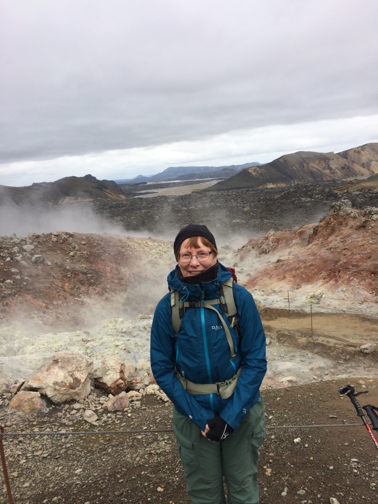
We all feel the pressures of modern life and achieving a work life balance may be difficult. However this trekker at heart has decided to get out there into the outdoors and live the dream. There will be ups and downs, heat and biting cold, discomfort and moments where a description may not do justice! The frequency of the posts will be determined by how and where my travels take me. It is not always possible to blog in real time (as I discovered recently in Iceland), so posts may appear following a trip being completed.
This is the first post on my new blog. I’m just getting this new blog going, so stay tuned for more. Subscribe below to get notified when I post new updates.
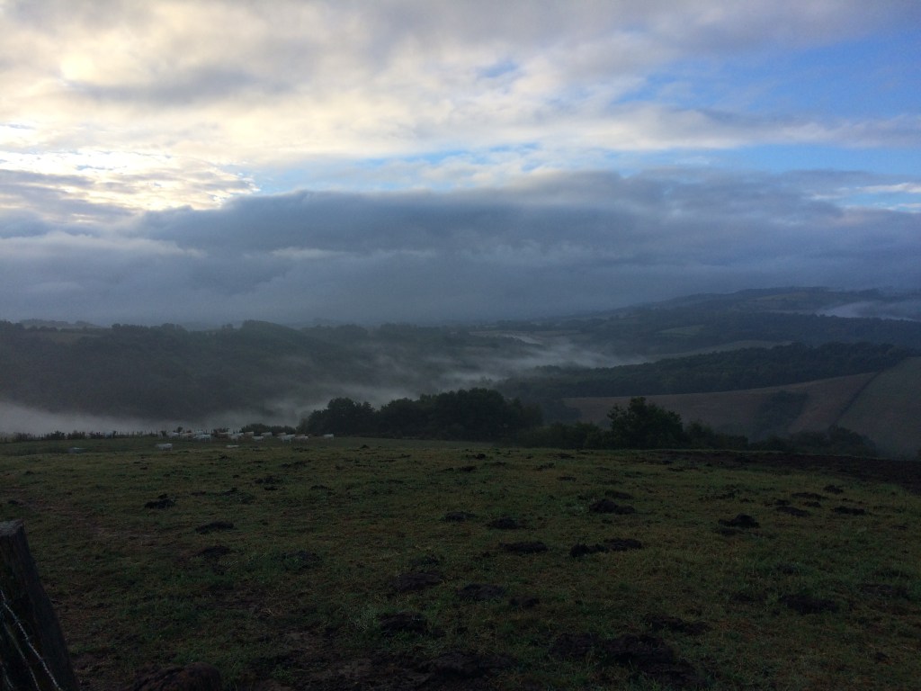
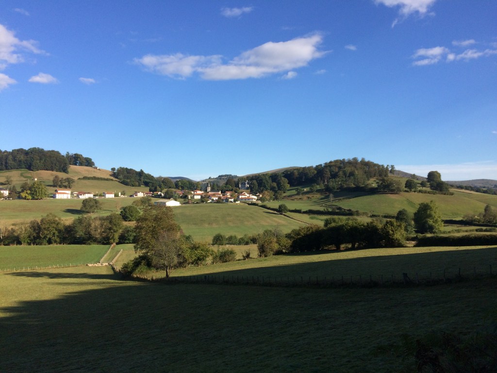
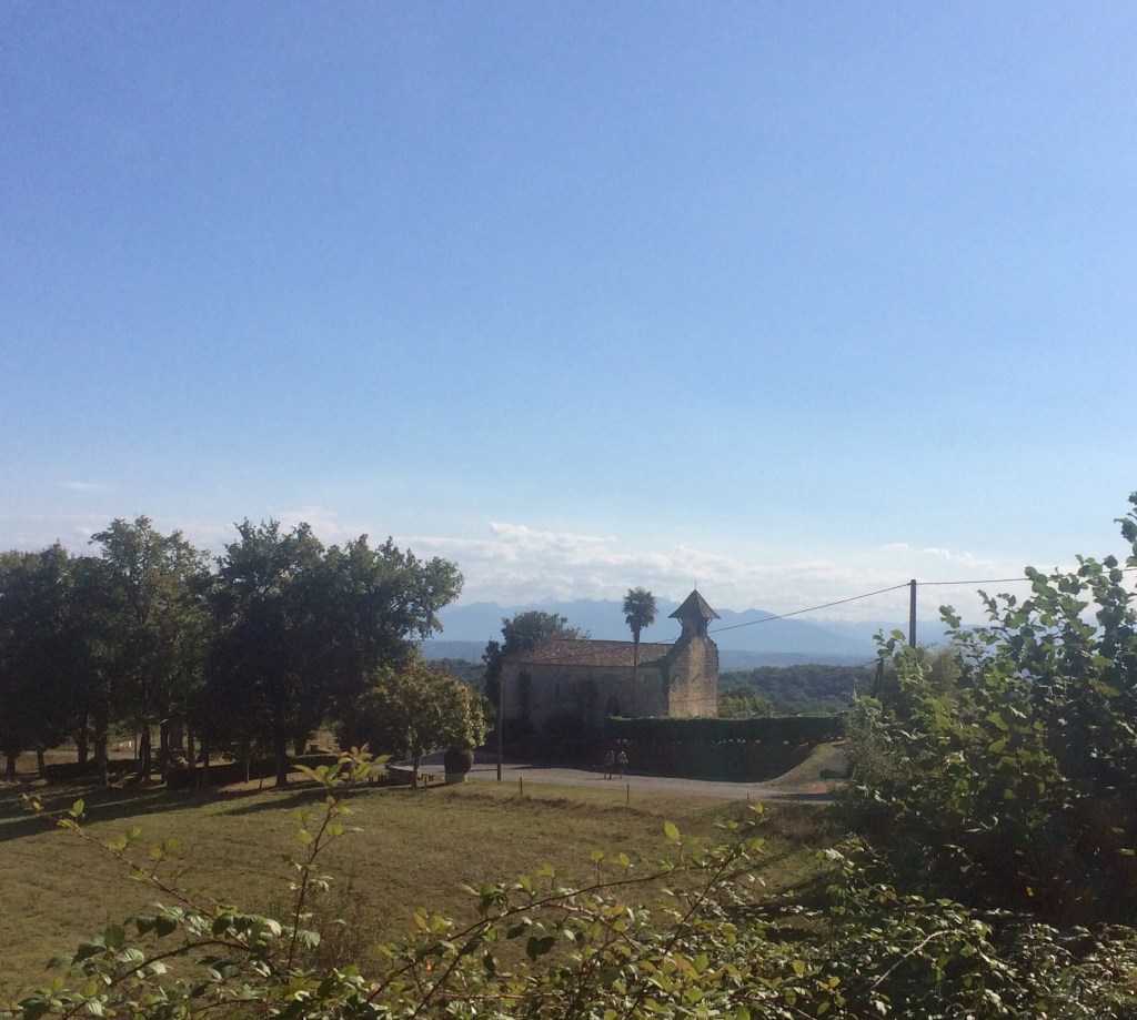
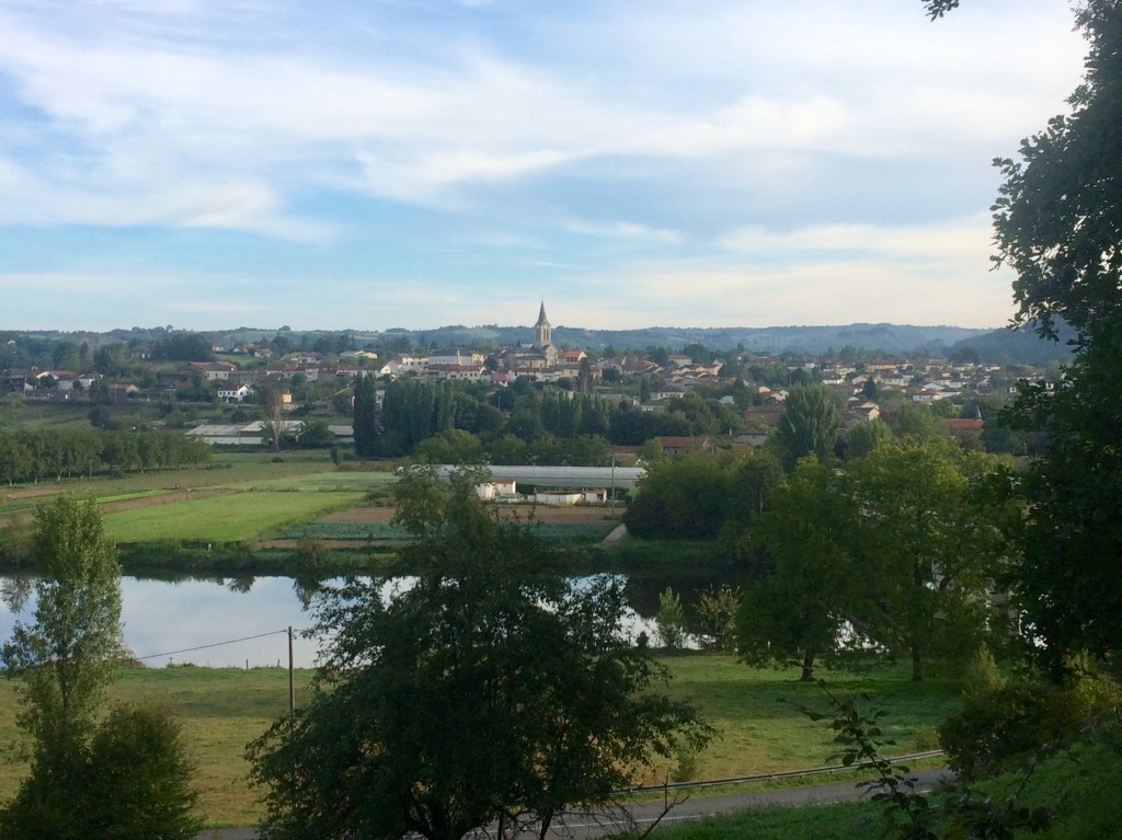
The early morning starts continued and where was it best to view the sunrise or the early morning mist but from the top of a hill! By this stage as I was now in the foothills of the Pyrenees there were plenty of hill top views to be had. There is something about the changing colours of the morning sky as well as the surrounding landscape that warms the heart ahead of a day of walking.
Morning sunrise in the Pyrenees foothills
So it was more up and down, up and down. I had thought that the worst was behind me but was then to face my toughest test one afternoon when heading for St Palais. I missed one of the important waymarking signs and found myself on the top of a hill looking at a sign which pointed to St Palais being both in the opposite direction and 7 km away. So I then took another route to get to St Palais but this proved to not be easy because some of it was through woodland and the forestry vehicles had been through earlier that day on top of rain the previous day.
Waymarking sign for the Sentier des Contrabandiers
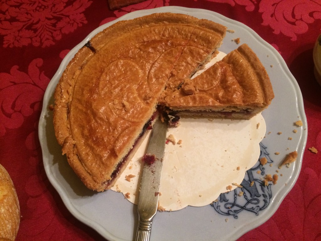
The result was thick rutted mud which I slogged through for close to an hour, stopping every 20 minutes to scrape it off my boots and consuming all of my snacks in the process. When I finally shuffled into St Palais the madame at my accommodation for the night was so concerned for my well being that along with a cup of tea I was also given a basque tart to eat (for energy). Just another example of some of the local kindness along the way.
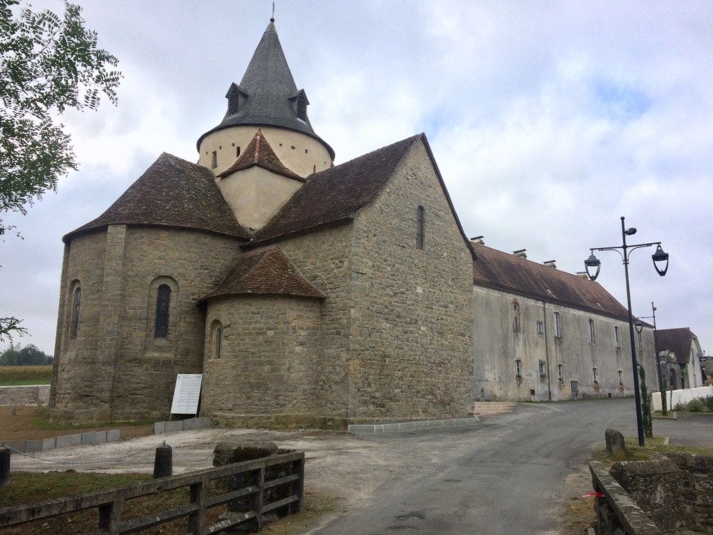
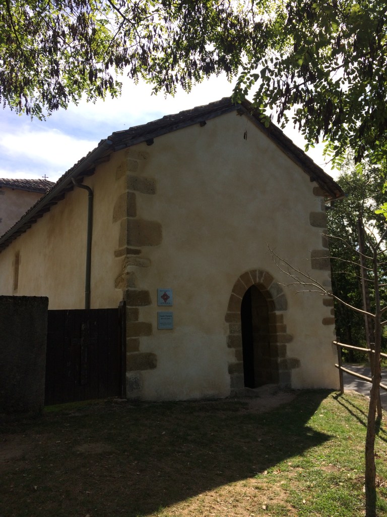
Eglise Larceveau
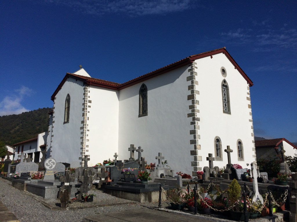
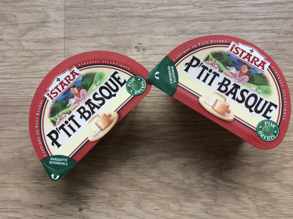
Following St Palais things were easier although I now had to pad my heels due to blisters. The slogging through the mud had been the last straw for my feet but fortunately I had come prepared for this eventuality. There were more opportunities to eat local produce, for example this P’Tit Basque cheese which I bought from a cheese factory (Fromagerie Istara https://www.ossau-iraty.fr/etape/fromagerie-istara-pyrenefrom ) on the outskirts of Larceveau. This particular fromagerie was on the road on the opposite side of Larceveau from my initial approach on the GR 65 (and to go into the town it was a short detour off the GR). By this stage of my journey I was eating as much as possible.
Brebis fromage
The final push towards St Jean Pied de Porte was marked by more rural scenery and of course more photo opportunities. During this stage of my journey the farm animals mainly visible in the fields were predominantly sheep
Rural scene en route to St Jean Pied de Port
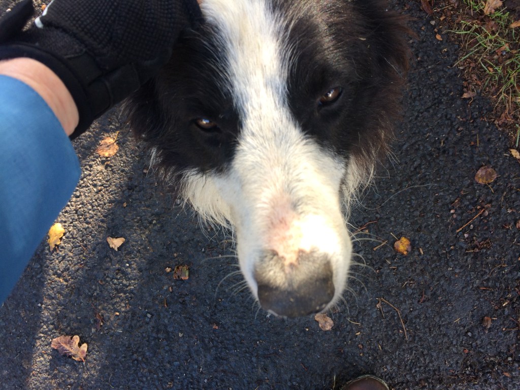
On my final day on the GR 65 I was accompanied by one farm dog for close to half a kilometre whilst another friendly older dog came for a pat as I passed by.
Patting a local dog on the final stage of my journey
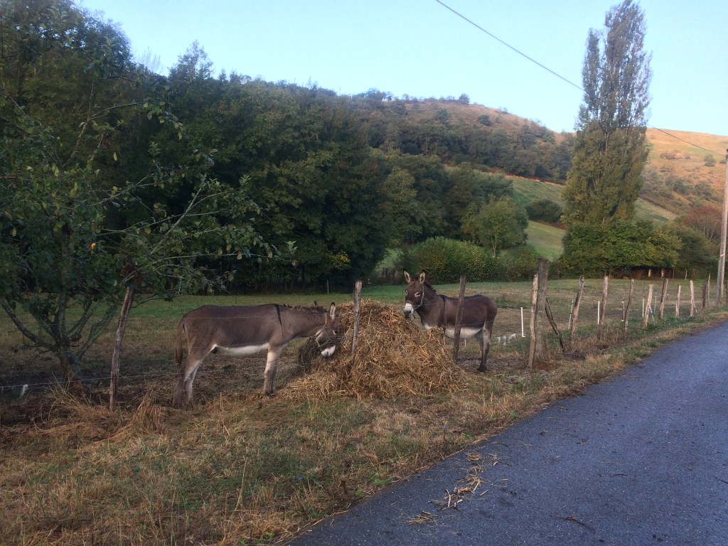
Then there were the donkeys. So often I had seen donkeys along the way and here was my final chance to photograph a couple of them.
Donkeys
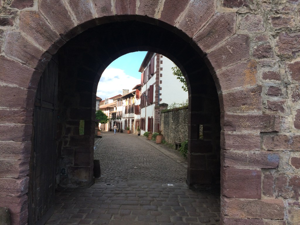
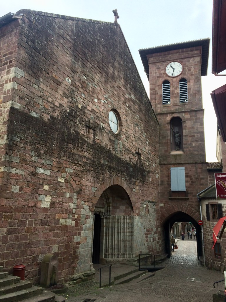
The final push up the hill into St Jean Pied de Port was marked by me having to navigate a traffic jam on the nearby road! Shock horror, a traffic jam due to the vehicles from all of the day trippers. Anyhow, I ambled by the stationary vehicles and reached my destination, the famous St James gate in the old medieval town wall! A moment to really savour after 760km!!!!
St Jacques Gate Saint Jean Pied de Port
After a well deserved rest and a celebratory drink there was time to have a preliminary look around part of the preserved medieval centre of St Jean Pied de Port. That night dinner was spent reminiscing with fellow hikers about our time on the Via Podiensis. A handful were continuing on into Spain along the well known Camino Santiago route.
Eglise Notre Dame du Bout du Pont
I had one full day to explore St Jean Pied de Port, along with enjoying some of the famous Basque tarts and browsing in the shops. I even managed to view the Pyrenees from the citadel perched atop a nearby hill along with walking along a section of the old town walls and checking out all of the medieval town gates.
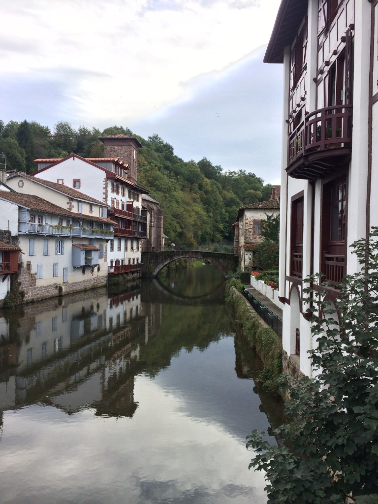
Looking towards the medieval bridge crossing the river Nive
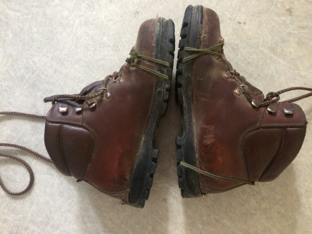
My final task was to respectfully dispose of my trusty hiking boots, which had been held together with twine for close to half of the route. They had served me well.
I left St Jean Pied de Port by departing from the railway station for what was quite a scenic rail journey along a valley to Bayonne where I switched to another train heading for the city from where I would finally depart France. What a trip it had been and the memories would last a lifetime!
The End. You can check out other posts about my journeys to other interesting places in the world.
There were always new sights every day on the GR 65 to behold. I can remember stopping and gazing at one small lake prior to Maslacq one morning. The reason I stopped was because this particular lake had both the greatest number and variety of water birds that I had come across so far on my journey. I was not able to do justice with my photographs but it would have been a delight for anyone with a good quality camera with a zoom lens! Shortly afterwards I walked through Maslacq and noticed a run down chateau as I was heading through the other side of the town.
Lake near the river Pau
Of course there were more hills and I can vividly remember when I first spotted the magnificent Sauvelaude St James church. I stopped off here to marvel at its interior along with watching a very informative video on the history including when it was part of an abbey complex. This church was sacked by the Huguenots, then restored, then sold off during the French revolution. Fortunately it is now being looked after by people from the nearby commune, plus it also contains an impressive statue of Saint James (hence the name). As I was sitting on a pew in the church the bells pealed for 12 am and I have to admit it was impressive hearing this thundering noise whilst inside. Then off I set again for what would be predominantly more road walking combined with a series of hills.
St James Church Sauvelade
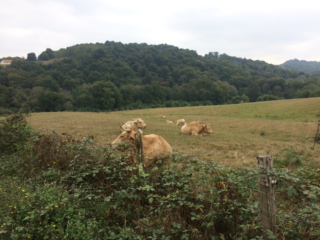
Bonjour les vaches I would say as I walked by some of the fields. Being the middle of the day the cows were all resting and I sometimes wondered what they thought about the steady parade of hikers passing by every day for at least half of the year. Of course they were probably used to it, hence why there was not much interest on their part on yet another hiker trudging by. The tranquillity of being out in rural France was only disturbed by the odd small car being frenetically driven by a local which would whiz by. Situational awareness and road walking skills are a must for many of the sections of the GR 65!
Les vaches
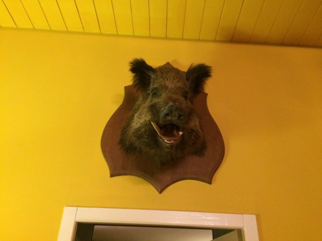
Between Sauvelaude and Navarrenx there are not many places to stop so I ended up walking into a field, sitting down and getting some snacks out mid afternoon. As I went to stand up there was some rustling in a nearby thicket and a small boar rushed away in the opposite direction. I was lucky in some respect that it was not a large animal and that it was more scared of me than I was of it. Up to then the only boars I had seen were those whose heads were mounted on the walls of some of the places that I had stayed in. If you want to see what they might look like in the wild you can watch this short video https://youtu.be/uXkPYWMDAoA
The closest I got to a French boar – le sanglier
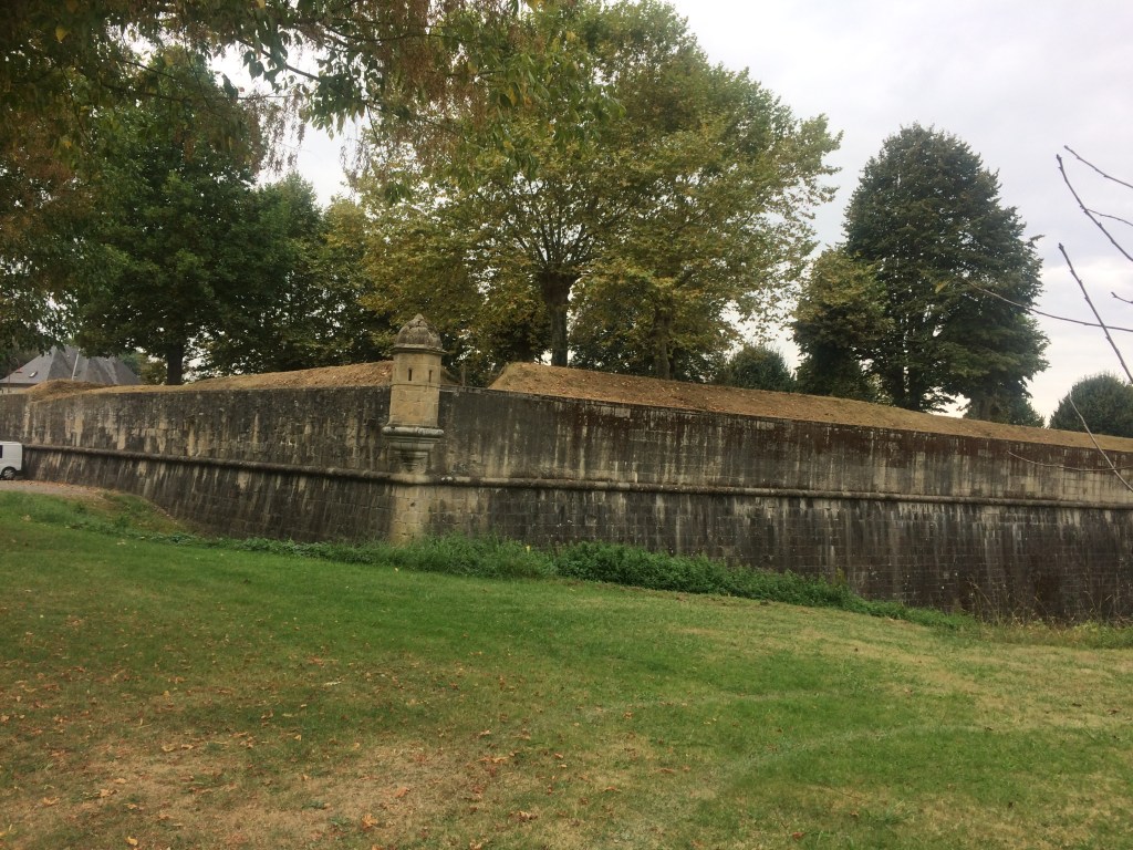
On the outskirts of Navarrenx I caught up with some of the hikers who I usually met up with for dinner each night. We compared notes, navigated a roundabout and walked into the outskirts of the town. The medieval centre was our final destination and we knew we were close to it when we saw the battlements. Navarrenx also had a number of shops (I can remember being ravenous and buying a mini pizza as well as more cheese and tomatoes for the backpack). Sitting down and enjoying a drink in the town square was a great end to this particular day. Of course the backpacks always attracted interest from other visitors and soon conversations were being held comparing notes on where everyone was from and where each of us was heading (and how).
Medieval battlements outskirts of Navarrenx
Crossing the Navarenx bridge I could gaze along the Gave d’Oloron and try and spot water birds. Looking back over my shoulder I could also get a final view of this preserved medieval fortified town. Just after this whilst walking up a hill I actually saw a rabbit!
Pont Navarrenx
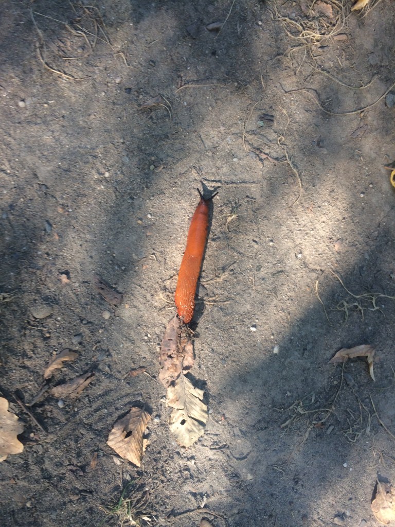
On any damp day walking through the forests had its own particular charm and this was the case on this particular stage. What with the smell of the damp vegetation, the patter of rain drops on the canopy plus a respite from the heat. I had never seen so many orange slugs up to now, and they seemed to be all over the place. Life as a slug in rural France was not without peril however because they were no match for those cars on the back roads it seemed. I noted a number of casualties whilst walking along some of the roads. It was also on this leg of my journey that I walked a whole extra circuit of a farm because I missed one of the waymarking signs in the rain! However I did manage to shelter beneath some very large trees out of the way for close to 45 minutes when the rain then became torrential, so there were pluses and minuses!
Orange slug on the forest floor
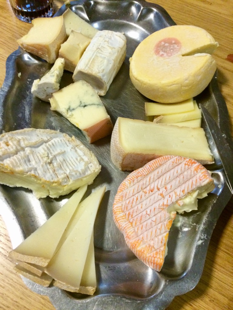
So when I squelched into my Gite for the night, damp from a day spent largely in the rain it was a relief to see how well set up they were for hot drinks, snacks as well as for the drying of clothes etc. Plus there were many other hikers with whom I could compare notes including from Austria, Spain, the United States, Australia as well as France. I learnt some more facts about French cheese from the locals along with sampling some of the delights that night at dinner. Dinner was well received particularly as four courses were served!
Cheese plate Ferme Boheteguia
Comparing notes with the other hikers who had also walked the whole route of the Via Podiensis all the way from le Puy was very informative. Many of us were also becoming excited that our journey was coming close to an end and that barring misfortune we should make it!
To be continued- Tales from the Via Podiensis- Finally the End is in Sight
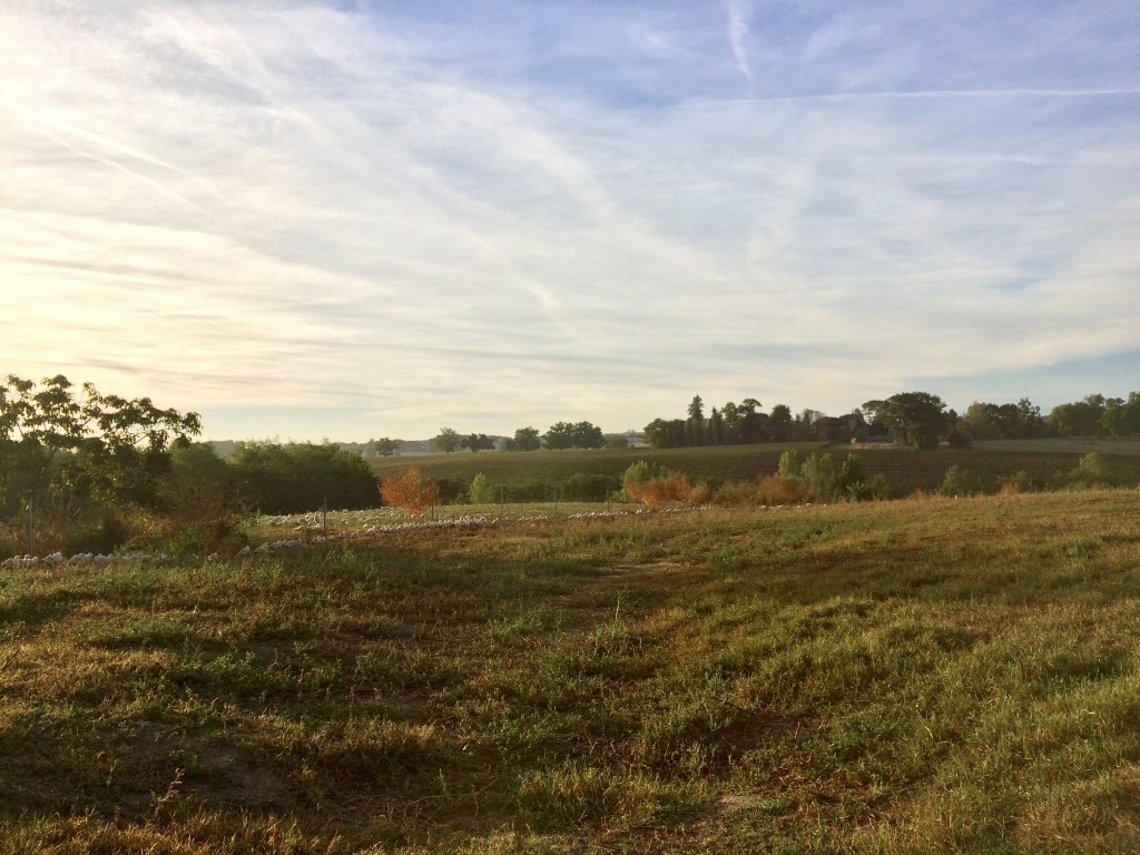
It was always nice to walk alongside water first thing in the morning as the sun was rising with the mist not as yet fully cleared. Some of the lakes were in fact reservoirs and the other major positive was that they also attracted various birdlife (which in some cases was protected).
Retenue de Brousseau
In between the wooded areas the rural scenery continued to be dominated by the presence of numerous maize fields. Plus some of the fields still had crops in them. So of course it was watch out for the large farm vehicles as well as the combine harvesters!
Walking alongside the fields
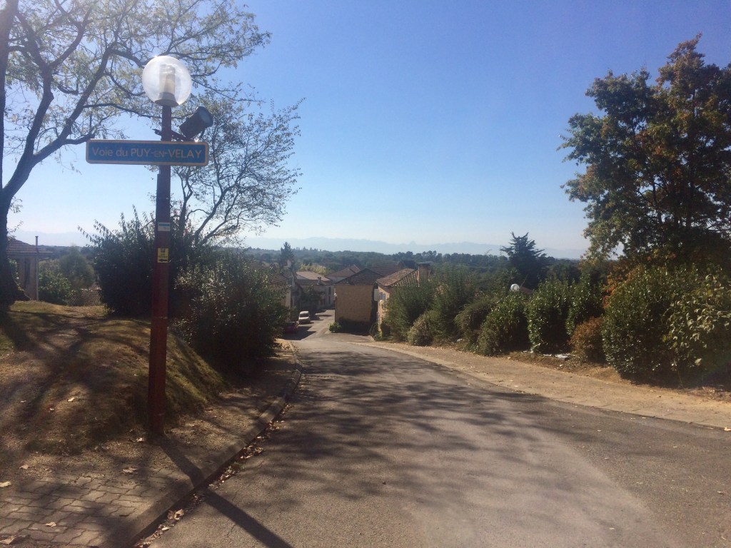
The days were usually very warm by mid morning and I can remember descending into the small village pictured below via the aptly named Voie du Puy en Velay, knowing that this was where I could find potable water! You can see how bright the sun is by the hazy appearance of the photograph below. Glimpses of the Pyrenees were now becoming commonplace from the various hill top vantage points.
The village of Miramont Sensaque
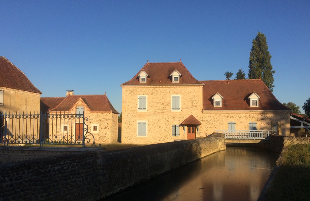
There continued to be a range of architecture that I passed with a range of various old buildings located in the villages as well as in the surrounding countryside. This old mill (pictured below), has been preserved and is now used by an organisation for other functions. You can clearly see the water channel which directed water under the mill.
Old mill – Chemin du Moulin
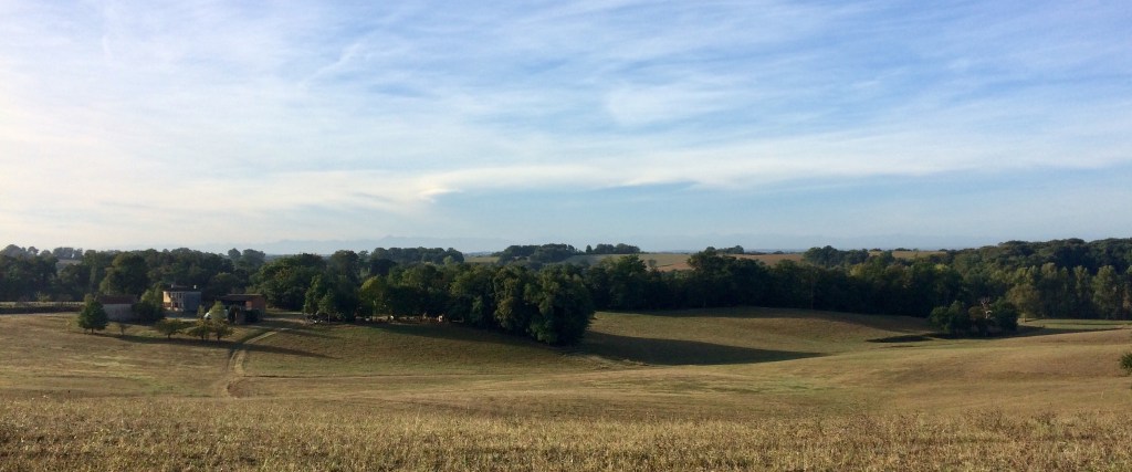
Along the way as I walked through or near various farms as well as along the hilltops there was more in the way of a number of magnificent views of the Pyrenees to be had. There were not as many farm animals to be seen as earlier on in my journey (particularly during the first week of the Via Podiensis).
View of the Pyrenees en route to Castillon, plus local farm dog!
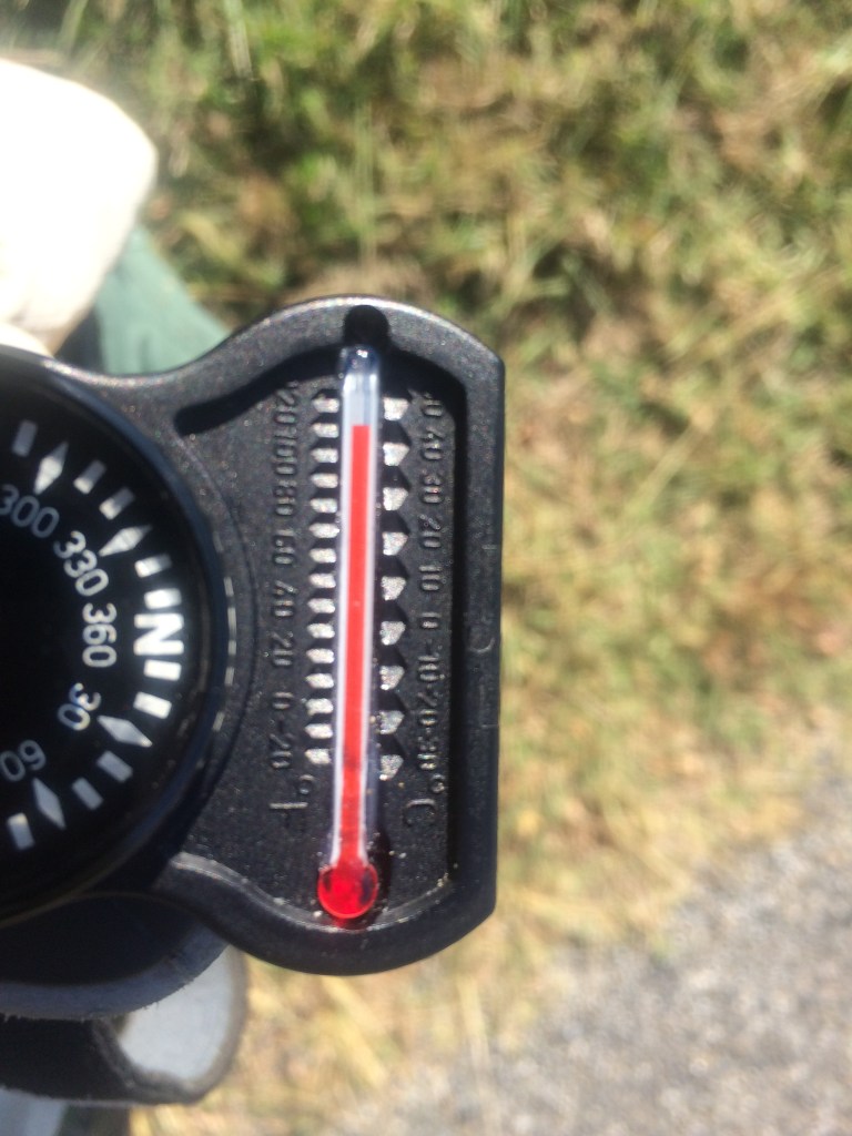
It was really hot at times and on my toughest day it was 42C (yes this reading is correct) for a period, which was measured whilst walking along a bitumen road in a valley with there also being no breeze. Hence why I was stopping at every church where there was potable water (and at times making up another litre of Hydralyte). I had learnt to measure the ambient air temperature to help gauge how much fluids I should be taking in.
At times the heat was brutal, particularly walking along the roads mid to late afternoon
This unusual looking small church (pictured below) afforded me yet another hydration stop and again I was not alone! On the toughest days during a stop at a church I would fill up one water bottle and tip most of its contents over the upper half of my body to help cool down. I had seen some of the French hikers do this earlier on in my journey and yes, I can state categorically that it helps. It was also an opportunity to compare notes with any other hikers who were also taking a break.
Eglise St Pierre, Castillon, another hydration stop
Again every hill afforded a view of the Pyrenees and sometimes something else. I had to be careful taking the photo below of an historic church because I was standing by a road and yes I had to watch out for those cars! This was just prior to the last push for the day up the final hill into Arthez de Bearn.
Chapel de Caubin, Pyrenees in the background
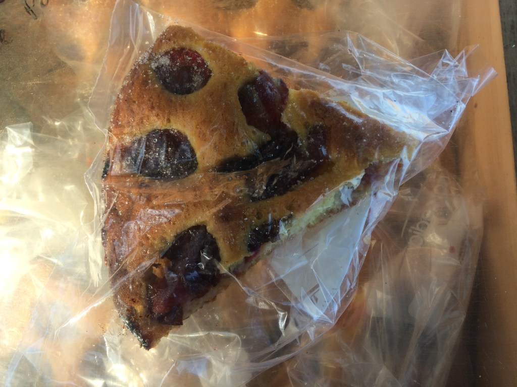
However once up in the town I was rewarded by being able to purchase some more bread at a local boulangerie for lunch over the next 2-3 days. Some of the more memorable food I remember from this stage included fish terrine and veal stew as well as Tarte de cerisses.
Tarte cerisses (Cherry tart)
To be continued- TalesFrom the Via Podiensis- k) The Pyrenees Foothills
By heading out in the mornings at first light I was continually amazed at some of the sights that I witnessed. On one occasion it was an early morning duck parade (pictured below), where the ducks that had been housed in farm sheds overnight were being let out to go and graze in nearby fields for the day. There was this orderly procession of ducks heading down a path from the shed towards the nearby fields. However in the process of obtaining some photos I was unfortunate enough to be zapped by the electric fence! I had not noticed the signs!!! Ouch ….
Early morning duck parade
There were acres and acres of maize fields either waiting to be harvested, being harvested or already harvested. So this meant that I had to watch out for large farm vehicles. In fact some of the combine harvesters were enormous!! Also when walking by the fields where there was a harvester in action I learnt to wait until the harvester headed away from the part of the field alongside which I was about to walk. Why? Well there were bits of maize that were being flicked out of the harvester by the breeze and I did not want dust in my eyes etc.
Rural landscape south west of Eauze, the Pyrenees are just visible on the horizon
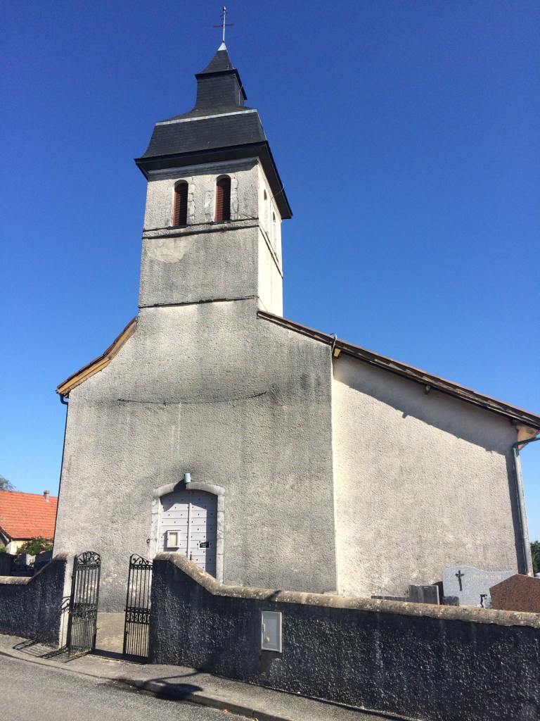
Cats continued to be a feature in some places. I had one visit my bedroom one evening at one place where I stayed and it was not uncommon to see cats either in the morning or in the evening if they were living at the accomodation where I was staying. Of course every town had an old church with its own significant history. For example the Eglise Collegiale Saint Nicolas in Nogaro had been used as a coal bunker during the French Revolution (you can still see the stains on the interior walls in places).
Eglise Collegiale Saint Nicolas Nogaro
Every now and then I came across some more medieval architecture out in the countryside. The following example is of some well preserved medieval farm buildings with a Gite also now being present on this particular site.
Medieval buildings near Gite Maison Labarbe
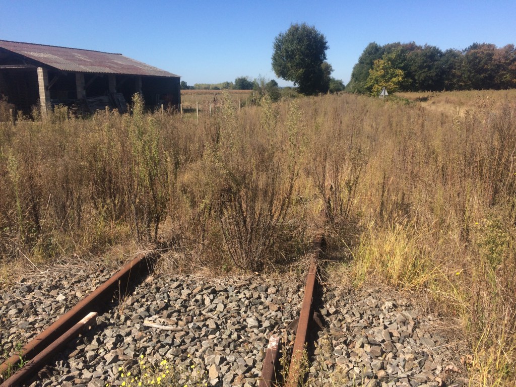
As a reminder of how rural France has changed with time, there was one part of the trail where I spent some time walking near abandoned railway lines. As it had not rained for a couple of months in this part of France, the vegetation was beginning to look quite parched in areas. However there were intermittent patches of woodland (useful to shelter out of the sun), along with more vineyards.
Old railway line
I can remember getting lost in Aire Sur L’Adour because the central historic part consists of a maze of narrow streets. So there I am holding a map standing beside a road, when a middle aged Frenchman drives up, slows down, winds down his car window and asks me if I am lost? I am not completely lost but I do need some assistance to find where my accommodation is actually located. I receive some instructions and off I set. Just another example of the help I received along the way usually from complete strangers!
Eglie Sainte Quitterie Aire Sur l’Adour
One other thing about rural France is the feel of the breakfast room with there being a range of both impressive kitchen ware and various effigies of poultry often on display.
To be continued- Tales From the Via Podiensis – j) Passing through Les Landes and first glimpse of the Pyrenees
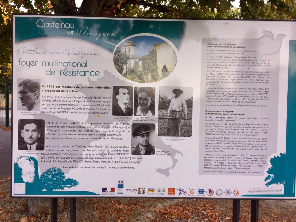
The early morning starts continue, with there sometimes being mist as I set off in the half light. I pass some more ponds which contain either croaking frogs or frogs making a rapid exit to safety hence avoiding being photographed! They are too quick for me. Every now and then I passed another poignant reminder of French history and this was very much the case in Castlenau sur L’Auvignon where there are multiple plaques outlining how the village was ransacked in World War 2.
Castelnau sur l’Auvignon
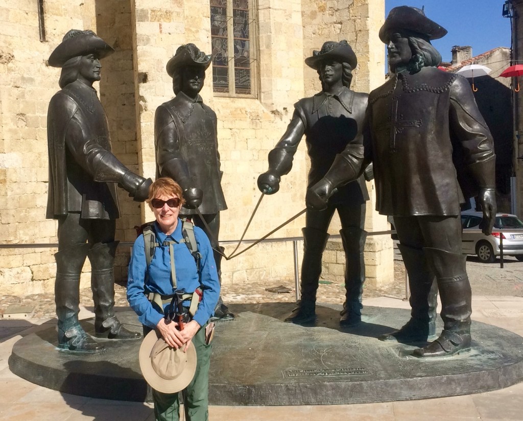
Then there are the moments of fun such as seeing an interesting art installation or posing with the 4 musketeers in Condom near the historic Cathedral of Saint Pierre on the town square. It was also a good place to stop and talk to people- the backpack attracted attention!
Posing with the Four Musketeers
With Condom being a larger town with a good range of shops, this was another place where I could stock up on supplies for the back pack! Plus on the outskirts of Condom is the attractive river Baise which I crossed first thing in the morning as I departed. There were even a few ducks on this particular river
Baise River, Condom
It was during this particular stage of my journey that I first spotted some red squirrels in the tree tops whilst I was walking through the forests (particularly during the morning). The squirrels all moved really fast hence there was no chance of a photo! However the good thing about being in the Department of the Gers is that I managed to eat Cassoulet for dinner on more than one occasion. Real hiker food this.
Montreal du Gers
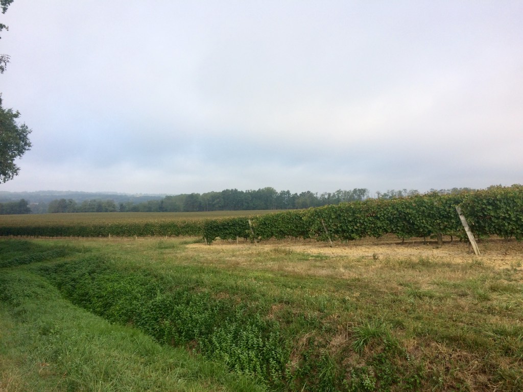
Also this region is wine growing country so there were numerous of grape vines which I also passed. At times you could see the grape harvesters at work and if it was a weekend you could hear the sounds of the dogs and bugles (because the hunters were out). In the ditches besides the roads there was often an assortment of self-seeded herbs, which made for a very pleasant smell at times.
Acres and acres of grape vines
It was also during this stage of the journey that I ran into hikers who I had not met before and we would sit down and compare experiences whilst having either a snack or meal breaks. There is a very good pop up cafe with amenities between Montreal du Gers and Eauze, where I also stopped and chatted to some hikers.
Look at all those grapes!
The final stage of the journey towards Eauze involved walking along what used to be an old railway line (which was built on an old roman road), hence why it was so straight! There were more squirrels to spot in the tree tops along with some of the locals who were out either horse riding, jogging or walking.
The path to Eauze
Eauze is an old roman town and some of this history is on display at the local museum. I can remember eating one meal in the town square with a fellow hiker as well as another purchased from a boulangerie. I had lunch whilst sitting in the very pretty garden of the rebuilt chapel of Saint Jacques which is located down a side street (Rue Hopital). There used to be a medieval hospital nearby (hence the name of the street). I was accompanied in the garden by one of the local cats! Plus as Eauze is the Armagnac capital of France, I did manage to taste some of this local product as well as eat some more French cheese! I also stocked up at a local supermarket including purchasing my favourite Cantal cheese for the backpack. One hint if you are fond of peanut butter, it is hard to come by in France.
Garden beside the Chapel of Saint Jacques, Eauze
It was also whilst in Eauze that I took advantage of a local laundromat (lavoire) and gave my hiking clothes a good wash! However working out how to use the coin operated machines required the assistance of the nearby madame who attended along with her small dog!
To be continued- Tales from the Via Podiensis-i) From the Gers to the Department of the Landes
My most vivid memory of crossing the Garonne river is that I slipped on the footpath on the bridge. So to avoid falling sideways onto the road in front of a passing car I threw myself forward and landed on one knee! Fortunately it was a short distance to the nearby bastide town of Auvillar. After a slow climb up the hill punctuated by separating two fighting cats, I arrived to find the town square deserted (and the tourist office shut). Mercifully there was a hotel bar which was serving drinks to some of the locals, so I was able to source some ice and then sit in the shade nursing my bruised knee.
Old market hall, Auvillar town square
Later in the day I was able to walk back to the edge of town and look out over the Garonne valley from a vantage point (featured in my initial blog post about the Via Podiensis https://debverranlivinglifeoutdoors.travel.blog/2019/11/06/tales-from-the-via-podiensis/). The very helpful tourist office in Auvillar is situated in an old building where Pope Clement V used to stay back in time. This also explains why the nearby Church of Saint-Pierre is so magnificent (it was all about political connections back then). This is because Auvillar was a wealthy town back in time due to the use of the nearby Garonne river for moving produce etc by barge. Attending an evening pilgrim service at the church is also a must if you have the opportunity.
Eglise Saint Pierre, Auvillar
As a reminder that every photo tells a story, it was whilst I was taking some photos of the Horlage (pictured below) that I felt a sharp stabbing pain above one shoulder. It took me a minute to realise that I had been stung by a wasp (through my t-shirt). By the time I quickly returned to my accommodation I realised that the bites were swelling up, so steroid cream was liberally applied (and this cream was to be my friend for the next 3 days to help manage the itching etc)
Horlage, Auvillar
One of my other memories of this stage of my journey was that any soup with crème on the menu was a welcome entrée from the set menu as I was having to pack the kilojoules in at night. I also walked through a procession of small villages, many with buildings reflecting their importance back in time. One example was the old hospital which is now a chateau at Saint-Antoine-de-Pont-d’Arratz. In the nearby square was a convenient WC which I took the opportunity to use.
Chateau Saint Antoine-de-Pont-d’Arratz
Then there was the welcome pop up stand near a farm with hot coffee and prune gateau on offer. This is why it was useful to carry some loose change along with low denomination Euro notes. However I still had to be careful of the nearby wasps because I did not need any more wasp stings. Plus I was nursing a bruised knee and a slightly corked thigh from the previous tumble whilst crossing a bridge over the Garonne river! However there were still views to be had in between what were largely empty fields (because most of the crops had been harvested).
Prune gateau, yum!
I also have memories of sharing one of my sardines (because bread and sardines was a lunch option some days), with a black labrador dog en route to Lectoure. I had stopped near the Eglise in Castet Arrouy for a break as there was a convenient picnic table nearby.
Medieval ramparts, Lectoure
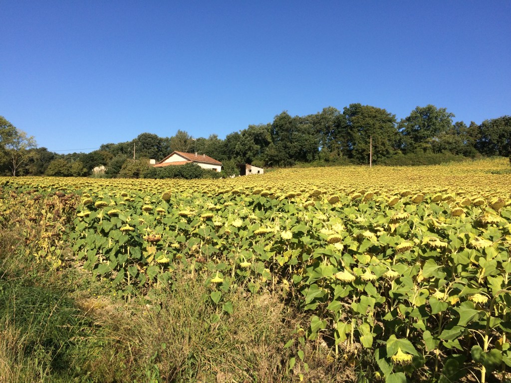
One morning I actually spotted a pheasant on the path near a field of sunflowers. By the time I had retrieved my digital device out of my back pack, the pheasant had rushed off into the nearby field and was out of site. So I took a photo of this sunflower field instead!
Sunflowers en route to Le Romieu
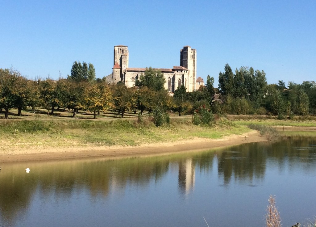
I knew I was getting close to Le Romieu when I spotted the impressive UNESCO listed Collegiale. Plus there were also some pretty landscaped gardens on the outskirts of Le Romieu complete with a suite of beehives for the local bees.
Collegiale, Le Romieu
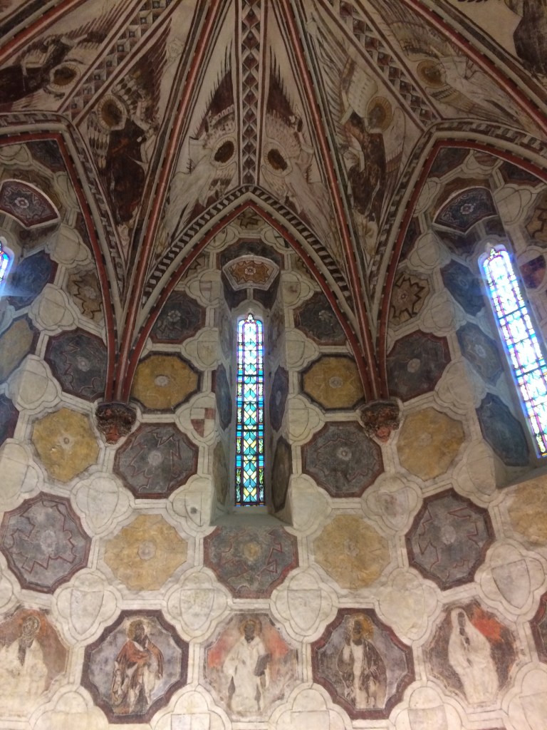
Once in Le Romieu I found the very helpful information centre located beside the Collegiale. The staff were really helpful, and asked if I needed help with accomodation (which fortunately I did not). I then looked around the Collegiale which is very historic and contains remnants of medieval painting on parts of the interior. This Collegiale was built because the then Cardinal (Arnaud d’Aux) was a cousin of the then Pope Clement V. Also by the nearby town square are some of the places where you can have a very pleasant meal.
Medieval painting, Collegiale Le Romieu
To be continued- Tales from the Via Podiensis- h) The Department of the Gers
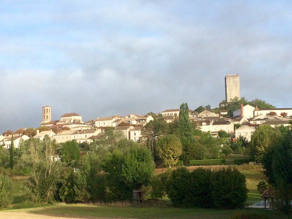
This stage of the Via Podiensis was marked by fields containing crops, along with the hilltop villages that have existed since medieval times and another UNESCO listed Cathedral. So there were more hills to climb, more eglises to stop and rest in and of course the views. Of note the bastide villages and towns are all situated on the top of a hill. Some of them I could see a from a reasonable distance before I made that final push up that inevitable hill. Others were best viewed by looking back over my shoulder as I departed.
View of Montcuq including an old tower and the spire of the Eglise
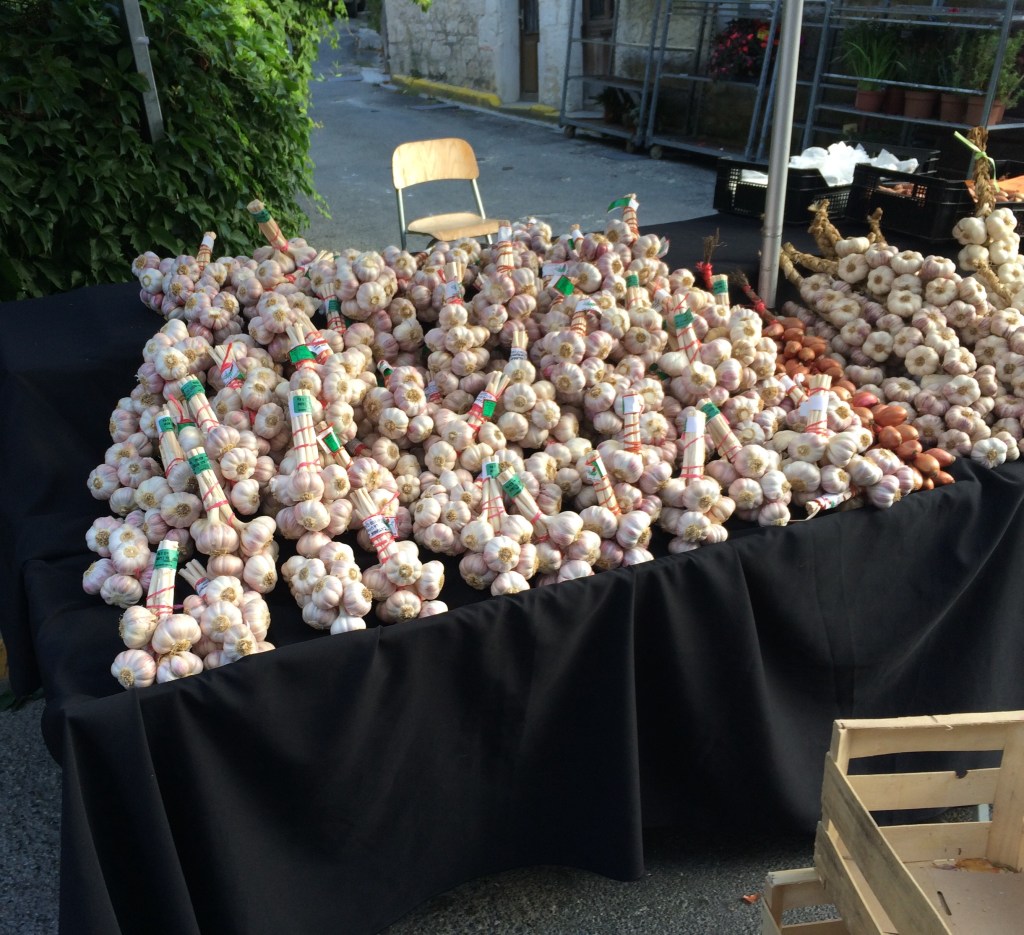
Having walked past numerous sunflowers fields where either the crop had already been harvested or the sunflowers were past their best it was always nice to see some fresh produce. One of the best markets that I came across one morning had an array of delights to chose from. I think it was the garlic stall which was the most impressive. Unfortunately this raw garlic was not going to go so well as a snack option with the bread and cheese already in my backpack! So I passed on the garlic.
Shall I purchase one bunch or two?
Walking through the Bastide villages sometimes in the middle of the day meant that there were more opportunities to marvel at all sorts of of medieval architecture. Of course not everything was open during the middle of the day but sometimes I got lucky! I remember walking into the outskirts of Lauzerte and seeing the temperature reading on the official electronic town sign. It was 32C! So it was a very slow climb up into the town (and another sojourn in an Eglise)!
Medieval houses Lauzerte
It was on this leg of my journey that one of my hiking poles snapped whilst walking down a hill. So I was down to one pole which although manageable required a bit of adjusting to. Scoring the odd apple from nearby trees continued to also be very much a bonus. I can remember having a late lunch near this small eglise (pictured below), prior to the final push into Moissac. Why did I stop there? It was the access to a nearby supply of potable water!
Eglise in the hamlet of Espis prior to Moissac
Once I was in a position to descend into Moissac I could look out over the Tarn et Garonne region and its patchwork appearance due to all of the various fields and copses of vegetation. However the actual descent was not without incident because one of the soles of one of my hiking boots partially detached (this had happened to the other boot earlier on). So I had to undertake a temporary fix (with twine) and shuffle slowly into town.
Moissac has the famous UNESCO listed Abbey church of Saint-Pierre, along with a very useful information centre situated right beside it. I was pleased that I also managed the tour of the cloisters as each one of the stone carvings represents something. The inside of the Abbey church is really impressive as well.
Close up of stone work in the cloisters Abbey church of Saint – Pierre, Moissac
A more robust running repair of the soles of my boots was then undertaken whilst in Moissac (as I was staying the night), which involved a combination of glue and twine (to hold the soles onto the boots). I was not prepared to try and walk in a new pair of boots at this stage of the journey.
Cloisters Abbey Church of Saint-Pierre, Moissac
The other good thing about Moissac is that it is by the Tarn river as well as being close to the nearby Garonne canal. So it was a pleasant change to have a riverside stroll along some non undulating terrain, and give both the legs and the feet a bit of a break.
Pont Napoleon and the Tarn River at first light, Moissac
It was very pleasant walking alongside the Garonne canal first thing in the morning (nb the mist). However I needed to be very much traffic aware because there was also a steady stream of people riding bicycles along the path as well.
The Garonne canal
What I also remember from this stage of my journey is having to raid my hiking snacks at night after eating at one hotel because the nouvelle cuisine style of food was nowhere near enough. By this stage I was eating 3 courses at dinner every night and each course needed to be an ample serving of food. This was due to me averaging 25km a day on the trail.
This is one of the more barren less inhabited sections of the Via Podiensis which contains evidence of human settlement that extends back to Neolithic times. By continuing along the classic GR 65 route this took me through southern part of the Causses du Quercy following my departure from Cajarc
Eglise St Etienne Cajarc
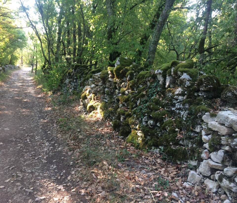
The one thing I remember most about the Causses was the presence of walled lanes (mercifully shaded in a number of instances), along with the remnants of old stone houses. However there are some great Gites in this region that I stayed in where regional French cuisine was on the menu (think pork terrine, duck sausage, lamb stew and goats cheese).
Old stone walls beside the trail
Every now and then I would spot an old dwelling made of the local stone (this region was far more intensively farmed back in time but is far less now as it is uneconomic), or an old well like this one near Veraire. There are some dolmens in this region but all of them are away from the main route, however I managed to detour at one stage to look at one of them.
Medieval stone well
It continued to be really warm during the days. Some of the road walking during the mid afternoon period once the bitumen was radiating heat (& there was no cloud cover), was fairly challenging. I can remember my thermometer measuring 34 C one afternoon around 4 pm. Mercifully the Gite owner of the particular accommodation I was staying in that night came looking for me after some of my weary companions indicated that I was going to be last in (it saved me walking the final leg of the journey that day).
One local Frenchman opened up the front yard of his house for the hikers on the outskirts of Bach on another particularly warm day. You could stop under a tree, have a chat and refill your water bottles!! Such kindness! It was a relief to get back under cover of the trees further on past this town and walk along an old roman road.
Old mill
The view of Cahors is worth stopping and admiring from the top of the hill before you walk down into the town. This was after I had walked along a section of the GR 65 which passed through a semi barren landscape. I was grateful that it was not raining that day as there was no shelter to be had. From that final hill top I could already spot the magnificent Pont Valentre to one side of the town. However I needed to watch those cars again, once on the outskirts before I crossed the Pont Louise Phillipe. I remember that it was another warm day and shortly after crossing the bridge I spotted a fountain. It took a lot of self control not to throw myself in order to cool down!
Pont Valentre- photogenic from every angle
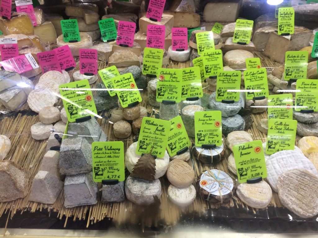
There are a number of shops as well as a market in Cahors so this was a great place to stock up on snacks for the backpack. My only problem was trying to work out how much cheese I could carry (and which ones)!!!
Fromages in the market hall, Cahors
Plus there are other sights in Cahors. There is a pleasant walk along the river Lot where I remember watching the lock being operated near the weir. Of course the Pont Valentre looked good from every possible angle! Plus I checked out the Saint Etienne Cathedrale, which also has its own church garden to the rear of the building. Then there was the poignant memorial to the French Resistance in the local mairie.
Tympanum Saint-Etienne Cathedrale, Conques
Cahors also has some nice parks as well as a post office, banking facilities and a number of shops. If you are looking for a special card or a small present then you may find it here. A tip for eating out is to avoid the main street and head for the back streets closer to the hospital – where there were some good priced smaller family type restaurants to be found along with some boulangeries.
If you think that this section of the Via Podiensis is all about walking alongside the Lot river, then think again! Although one comes across the Lot at times, and I crossed it via various bridges, most of the time was spent walking in the hills of what is the northern Aveyron in order to get to the next destination (and accomodation)! So think hills, lots of hills ….. and more medieval architecture including one spectacular Romanesque cathedral
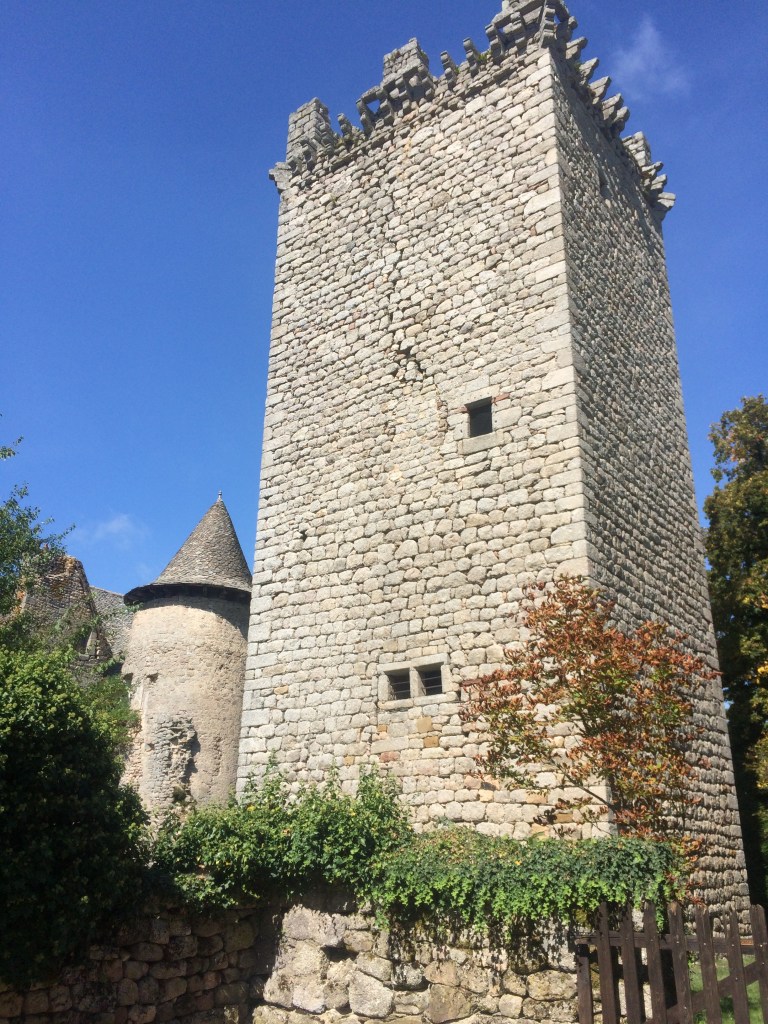
Chateau and tower, Senergues
In between the small towns with their medieval architecture I also passed numerous chestnut trees which were laden with nuts. When these nuts happened to drop because they were enclosed in a softer outer case they fortunately tended to bounce, including off me!
Chestnut trees
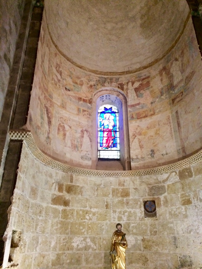
The most famous Cathedrale in the northern Aveyron is the historic Abbey Church of Sainte- Foy which is UNESCO listed due to its association with the Camino Santiago https://www.tourisme-conques.fr/en/en-conques/st-foy-abbey-church. One small tip, the last 3- 5 km down the GR 65 into Conques is basically a downhill trek across rocks. This was memorable because I had already walked close to 28km before I even started this final downhill section. Some people in the know avoided this bit and walked into Conques via the road. Other tourists took the bus! So it was quite busy when I initially arrived there- by that stage shuffling along the cobble stoned streets on tired legs.
The front of the Abbey Sainte Foy, Conques
However I found myself in what is a very well preserved medieval village (which is worth walking around) and there were plenty of places to stop off for a drink or a bite to eat. Once I was inside the Abbey Cathedrale and looking up at the high ceiling, I was left wondering how had they managed to build it? Plus the acoustics were pretty good as well (I was there towards the end of an evening service). It is hard to fathom how this was all taken into account during the initial build of the abbey.
Looking up at the Dome and ceiling of the Abbey Sainte-Foy Conques
Then you realise that pilgrims and hikers have been have been coming this way for centuries (and are still coming). The route out of Conques via the GR 65 is also fairly spectacular although one had to watch for bikers (motorcycles) on the back roads. There was an equally challenging walk up a hill the other side of Conques where I stopped at a small chapel to admire the view, although in my case it was still misty so no view that day. This was followed by a reasonable amount of road walking so it was watch out for the cars again!
Porte du Barry, Conques
Whilst walking part of this route during a weekend I came across a group of French hikers (there were close to 20 of them), who were also on the same narrow track alongside a road. It was always best to keep off the roads if possible! I had stepped to one side to give way, when the lead hiker asked me where I was from and as to where I might be heading. When I said that I had departed from Le Puy and was walking the whole route of the Via Podiensis to St Jean Pied de Porte, I was greeted with “Vu Pelerin” and with that the whole group gave way for me!!! More “Merci beaucoups” followed as I passed by everyone. Later that same day I also chatted with the bilingual guide of another group also out for the day who stopped for a picnic lunch in a park near another old church. I had already stopped for a snack break in the shade!.
The one downside of having to walk along sections of road in the afternoons was that on the hot days (30C), the bitumen absorbed the heat so that by 3-4pm in the afternoon you could also feel the heat radiating up from the road! It was during this leg of the journey that I spotted a woodpecker flying in woods not far from Decazeville and then shortly afterwards I heard another one calling (sounded exactly like woody woodpecker in the old cartoon series from years ago). However do you think I could ever get a photo of one of these woodpeckers? No, and it was not for lack of trying!!
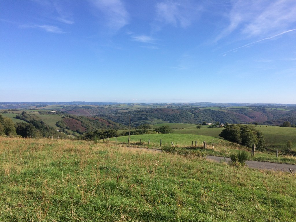
Hills between Conques and Decazeville
One of the best views I had of a town by the river Lot was that of Livenhac Le Haut but as it was first thing on a Sunday morning when I got there everything was still shut! So it was a short sojourn passing through this particular town. However by 11 am that same day it was 30C and I was again seeking shelter at times for hydration breaks.
Livenhac Le Haut by the Lot River
One of my ways of obtaining a respite from the heat during the day was to go inside the eglises, including the one pictured below. In that particular case, I was able to refill my water bottle nearby and wash off two apples that I had picked up earlier. Later on after walking through maize fields where the ambient air temperature was 35C, I stopped off for more potable l’eau at St -Jean Mirabel.
Chapelle de Guironde
There were to be more surprises including coming across two French hikers wrangling figs from the higher branches of some of the fig trees beside the trail (and then sharing them with me), along with managing to pick a bunch of grapes off a grape vine right by the trail. On the hot days fruit was a very welcome snack. One night was spent in Figeac where by chance I managed to tour the Maison des Templiers and attend an evening trumpet and organ recital at Saint Sauveur with some of the other hikers.
Maison des Templiers
One early morning departure (at first light) had me spotting frogs hopping into a pond as I walked by (this happened on several occasions but the frogs were always too quick for the camera!). I was to then meet up with yet another group of French hikers, because they had stopped to wrangle fruit off some plum trees! I heard about their other camino treks (they spent 2-3 weeks each year camino walking). Shortly after photographing this dolmen I stopped for another hydration break, “Ca Va” I was asked, “Oui Ca Va” I replied. I was to walk on and off with this same group of French hikers for another 2-3 km, then they left me behind!
Grealou Dolmen
It was extremely warm some afternoons!!! The closest I got to sustaining leg cramps was on the final downhill leg into Cajarc as it was hot and there was no breeze (plus there were plenty of rocks on the trail)!. It was only because of my consumption of Hydralyte that I made it into the town. However I was rewarded by seeing another couple of woodpeckers near the old town ?water supply on the hill as I walked by. A woman hiker at dinner that night let me know that she had taken the shorter route via the road!
To be continued: Tales from the Via Podiensis-e) The Causses du Quercy of the Lot Department
If you have only a couple of weeks to walk along the Via Podiensis in France (the GR 65), then the section that crosses from the Lozere region into the Aveyron is a must. It has everything, scenery, medieval architecture, good company (as there are plenty of hikers on this section) and great towns to stay in at night. Plus this encompasses some of the upper Lot Valley and its namesake river. However every morning always seemed to begin with an obligatory climb up a hill sometimes after crossing over a medieval bridge.
Departing St Chely d’Aubrac
Following the initial hill climb each morning there was often an opportunity to stop and compare notes with a couple of (or more) fellow hikers. Then there were would be a series of more hills occupied by either woodland or farmland. Some of the local farmers had set up pop up refreshment stands which provided a welcome opportunity to take a break (and grab a coffee for 1 Euro). One of the noticeable differences during this stage was that there were far less cattle to be seen, but there were still the chickens!
Les poulets
Sometimes you could look down on to the next town from a distance or look back up depending as to what was your exact location on the GR 65. Probably one of the best views of St Come d’Olt is to be gained whilst crossing the bridge across the river Lot heading for the next town. I was also fortunate to spot a bright blue kingfisher flying along the Lot shortly afterwards. However there were not that many ducks around, which may reflect the fact that historically they have been hunted. Plus there are plenty of opportunities to have duck confit or guinea fowl for dinner but this is due to the fact that these are farmed.
Both St Come Dolt and the town of Estaing have well preserved medieval centres which are worth the walk around, although in the middle of the day it can be quite warm! I did try to persuade one group of hikers not to miss Estaing (as foot blisters and tendonitis had become a problem and they were going to be transported by road through to Conques).
Entrance to the medieval centre of St Come d’Olt
There are a number of magnificent churches along the way and on a hot day they were a really good place to have some respite from the heat. Plus many of the churches are a source of potable water, which I was thankful of on several occasions, particularly by mid afternoon. It was on this particular leg of the Via Podiensis that I first experienced heat rash because it was a lot warmer in the valleys especially if there was no breeze compared to being up on the Massif Cebtral. This led to some adjustments with my hydration regimen along with venting of my hiking shirts!
Medieval painting on the ceiling inside the Eglise Saint Hillarian
Then there was Espalion, with the exquisite view to be had as you walked into this town alongside the Lot river. Also, Espalion had shops, which was one of the places where I stocked up on snacks for the backpack.
Chateau on the river Lot, Espalion
Plus there was another quite spectacular medieval bridge to also look at. No cars are allowed on this bridge either which was not the case in Estaing where you needed to be particularly traffic alert whilst crossing the bridge into that town.
Medieval bridge Espalion
Every picture tells a story and the St Pierre de Bessuejouls eglise (pictured below), is one. Prior to encountering this particular eglise one morning I found myself walking behind a group of French hikers who were singing the Ultreia pilgrim song. I then opted to stop and check out this magnificent church whilst the French hikers marched off into the distance. I thought that I would never see them again that day at the pace that they were walking.
Eglise de Saint Pierre de Bessuejouls
However it is on the section of the GR 65 not long past the St Pierre-de-Bessuejouls Eglise that there is a serious uphill climb through some woodland. In fact it is recommended that in bad weather you walk instead via the road as this part of the trail can be treacherous. Halfway up the steep slope I found the members of the French group who had all stopped and were no longer singing but instead gesticulating. One of them asked me if the batons (hiking poles) were useful (in French). “Oui Oui” I said as I passed by. Of note this was one of the few times that I passed French hikers, because most of the time they were passing me!
The route close to Estaing was memorable for some of it being along a road where it was essential to be fully traffic aware. The vehicles pass by really close at times and they did not slow down either! Then I had to navigate the narrow one lane medieval bridge into the town. A good time to cross the bridge is during the 2 hour lunch break because there is far less traffic at that time! However I will never forget sitting outside an eatery in Estaing comparing notes with other hikers and watching large trucks (or tractors) navigating the narrow streets. One tip, if you book accommodation near the main road which passes through Estaing then be prepared for vehicle noise through the night!
Estaing view
Some of the smaller villages were really quite pretty what with the old houses and the flower boxes. Shortly after I took a photo of the outskirts of Golinhac I stopped in the square near the church for an early lunch just as the church bells pealed at 11 am. I was joined by a woman French hiker who I had already talked to earlier in the day (just after the obligatory morning hill climb whilst having a hydration break). We had already compared notes on other long distance walks and I had seen some of her impressive photos from the Camino Santiago.
Golinhac village
It was not often I missed the trail markers but on the way to Espeyrac was one occasion where this happened. Gazing around at the scenery as I was descending from the last hill prior to this town meant that I found myself on a road and suddenly there was no sign of the usual trail markers. No worries, I pulled my trail notes out and realised that I could see this village in the distance, so I stayed on the road (and scored some nectarines from a large tree on the edge of the village)!
Saint Pierre Eglise, Espeyrac
I picked up the trail markers in Espeyrac and headed off. After a couple of kilometres I came across the same woman French hiker I had met earlier in the day who informed me that I was heading in the wrong direction! I followed her back towards Espeyrac (and went past the church for a second time), and was back on the trail. Merci beaucoup!!! There were more hills to climb that day!